There is a phrase buried in the archives of the Inyo Independent, a small newspaper once published in the town of Independence, California. It appeared in December of 1882, describing the gold mines hidden in the canyons above as workable only “with infinite toil” ¹.
I live in those mountains. Have for six years. And it’s one of the most honest descriptions of this place I’ve ever come across — it fits the terrain as much as the mining itself.
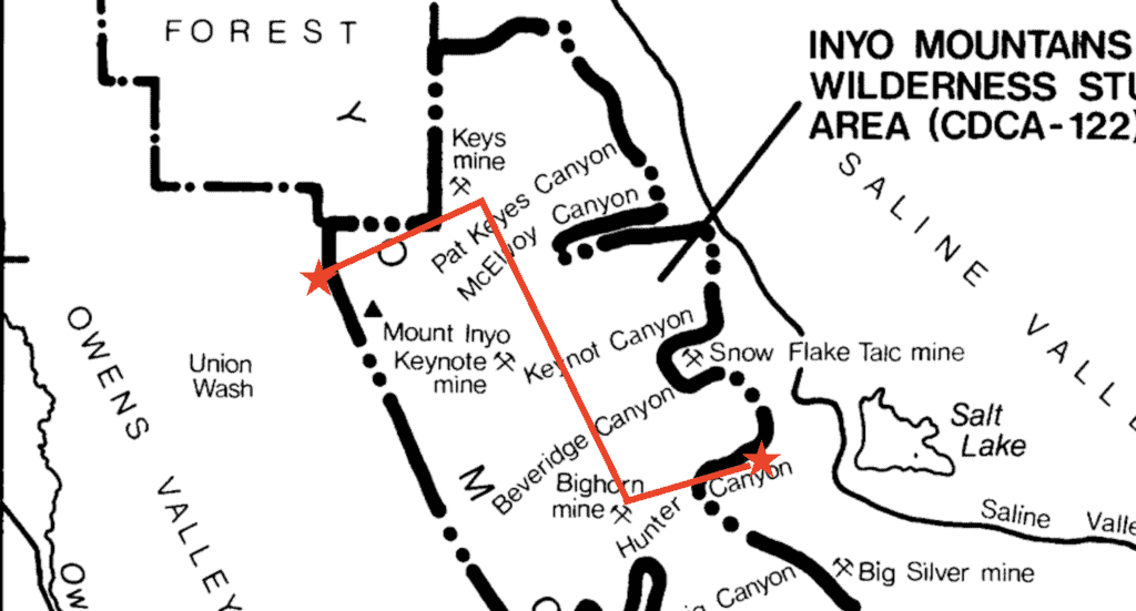
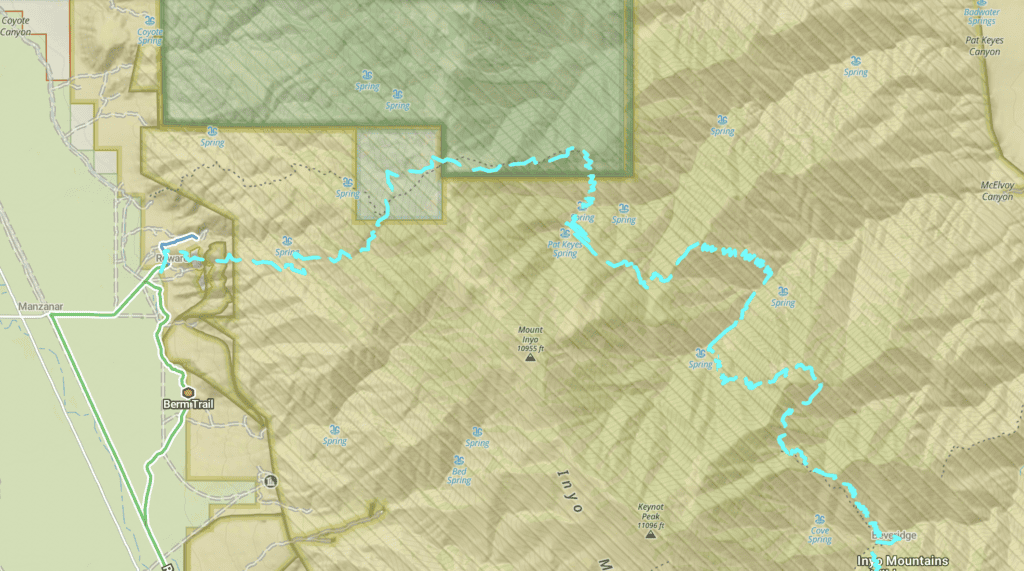
Those same canyons — steep, remote, and unforgiving — are what the Lonesome Miner Trail crosses today. The route cuts through the old Beveridge Mining District, one of the most isolated and least-visited backcountry areas in California. It starts at the mouth of Pat Keyes Canyon on the western side of the range, climbs over ridges above 11,000 feet, drops into McElvoy and Keynot Canyons, and eventually reaches Beveridge Canyon, where the ruins of one of California’s most intact ghost towns are still slowly being reclaimed by the desert.
The exact route varies, but most traverses cover somewhere between thirty and forty miles, with roughly 15,000 to 25,000 feet of cumulative elevation gain and loss. No maintained trails. No signs. Long stretches where the route simply disappears and you’re left to figure it out for yourself.
Karen Swope, whose 1993 dissertation on the Beveridge Mining District borrowed the phrase With Infinite Toil as its title, understood these mountains well ². So did the miners who worked these canyons 140 years ago.
And if you hike the Lonesome Miner Trail, eventually, so will you.
I live in the Inyo Mountains myself, up at Cerro Gordo, and I’ve completed the traverse a few times.
This is the article I wish I’d had before I went.
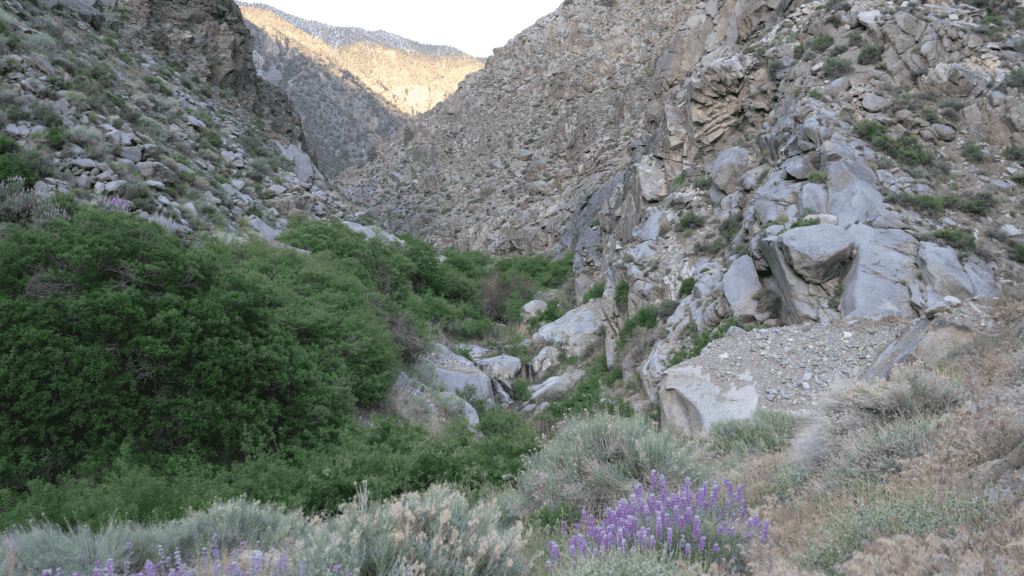
The Setting: The Inyo Mountains
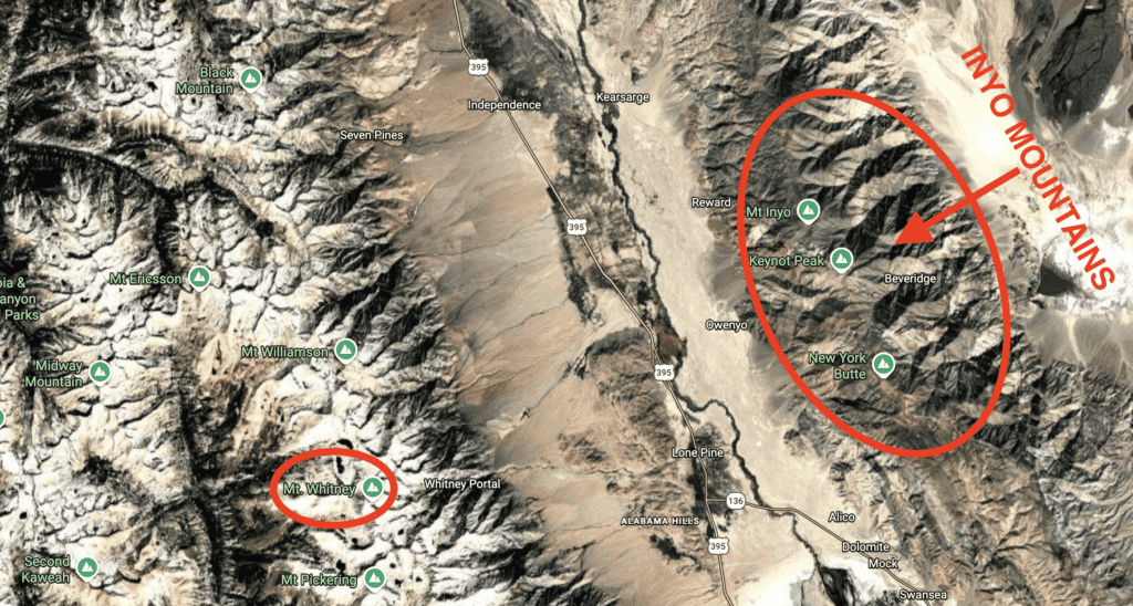
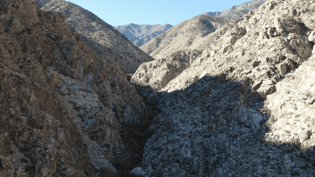
Most people who visit the Owens Valley spend their time looking west — toward the Sierra Nevada, toward Mount Whitney, toward the Pacific Crest Trail and the crowds that follow it every summer. The Inyos are the range on the other side of the valley, running parallel to the Sierra along the valley’s eastern edge. They’re rugged, steep, and almost never visited. Their western face drops into Owens Valley; their eastern face presses hard against Death Valley National Park and Saline Valley. A series of deep, parallel canyons cut the range from west to east, draining off ridges that top out above 11,000 feet and plunging thousands of vertical feet in just a few miles.
A different newspaper in the 1800s described the canyons as “so nearly vertical, as to be inaccessible to anything without wings” ³.
They weren’t wrong.
No paved roads cross the Inyos. No maintained trails connect their canyons. The BLM’s Bishop Field Office manages the range, and most of it falls within the Inyo Mountains Wilderness — which means the trails aren’t maintained, the route isn’t signed, and the experience is about as close to genuine wilderness travel as you can find in California outside of the most remote corners of the High Sierra.
The Beveridge Mining District sits on the eastern slopes of the range, in those inaccessible canyons, at elevations ranging from about 5,000 feet on the canyon floors to over 11,000 feet on the high ridges. In the 1870s and 1880s, miners found their way in and extracted an estimated 38,000 ounces of gold and 39,000 ounces of silver ⁴ — over $100 million at today’s prices — using nothing but mules, hand tools, and a particular kind of determination that is difficult to fully understand until you’ve been in the terrain yourself.
What they left behind is still there.
The History: How Beveridge Happened
The Silver That Started It All
Before anyone filed a claim in the Beveridge canyons, there was Cerro Gordo. A silver mine just to the south that was the largest mine in California in the 1860s and 1870s. At its peak, Cerro Gordo had thousands of residents, hundreds of buildings, and produced millions of dollars worth of ore ⁵. It built Los Angeles. It drew people from around the world. And then, like all mines eventually do, it started to run out.
I’ve lived at Cerro Gordo for six years now, doing my best to bring it back to life — restoring the old buildings, exploring the surrounding land, trying to understand the place on its own terms. The mine is quiet today, but it still holds the weight of what it was. Spending that much time up here gives you a particular appreciation for what it meant to work these mountains before roads, before power, before any of the infrastructure we take for granted. When I first started reading about the miners who left Cerro Gordo and pushed north into the Beveridge canyons, I understood the impulse immediately. When the ore runs out, you have to find new ore.
By the mid-1870s, the richest silver ore at Cerro Gordo had been mined out. But the miners it had brought to the Owens Valley didn’t leave. They moved north, following the Inyo crest, looking for the next big strike. The trails they set up, the supply networks they built, and the knowledge they carried with them made the Beveridge District possible.
The Men Who Were There First
These days, the founding of the Beveridge Mining District is credited to W.L. Hunter — a man whose cabin at Cerro Gordo still stands today, right here where I live. But before Hunter rode into these mountains, there were Mexican miners already pulling gold out of them. The evidence is everywhere: circular arrastra pits, the stone grinding mills introduced by Spanish miners centuries earlier, show up throughout the canyons and predate any American claim. Archaeologist Karen Swope established that Mexican miners had been working gold here since at least the 1860s, likely drawn north from Cerro Gordo when the silver ran out ⁶.
The most telling account comes from the early history of the Keynot Mine — the most productive operation in the district. When the first American miners arrived, they found Mexican miners already working the ore body. Those miners had been hand-sorting the richest ore for years, sometimes casting it directly into balls of nearly pure gold “varying in size from a bullet to a hen’s egg” ⁷. The Americans eventually bought the property. The Mexican miners kept working it.
The “Founding”, 1877–1878
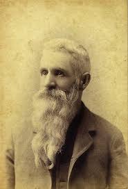
On December 7, 1877, a group of miners met at a spring in what they called Big Horn Canyon and formally organized the Beveridge Mining District ⁸. W.L. Hunter presided — making his way over from Cerro Gordo, the same route I drive today when I come down off the mountain. Hunter was a former Confederate soldier who had spent years working mines across the West before landing in the Inyos. He proposed naming the district after a prominent local figure named John Beveridge ⁹. The name was approved and still stands. Hunter worked these canyons until his death in 1902. He never left. I can see his cabin out the window I’m writing this from. You can still visit a mountain named after him just to the east.
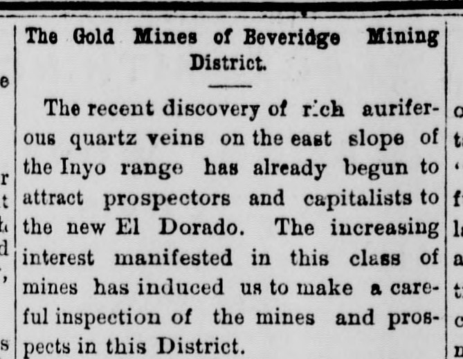
By 1878, the Inyo Independent was calling the new district “a new El Dorado” ¹⁰. That phrase had been applied to pretty much every California gold rush since 1849, but in this case it wasn’t entirely wrong.
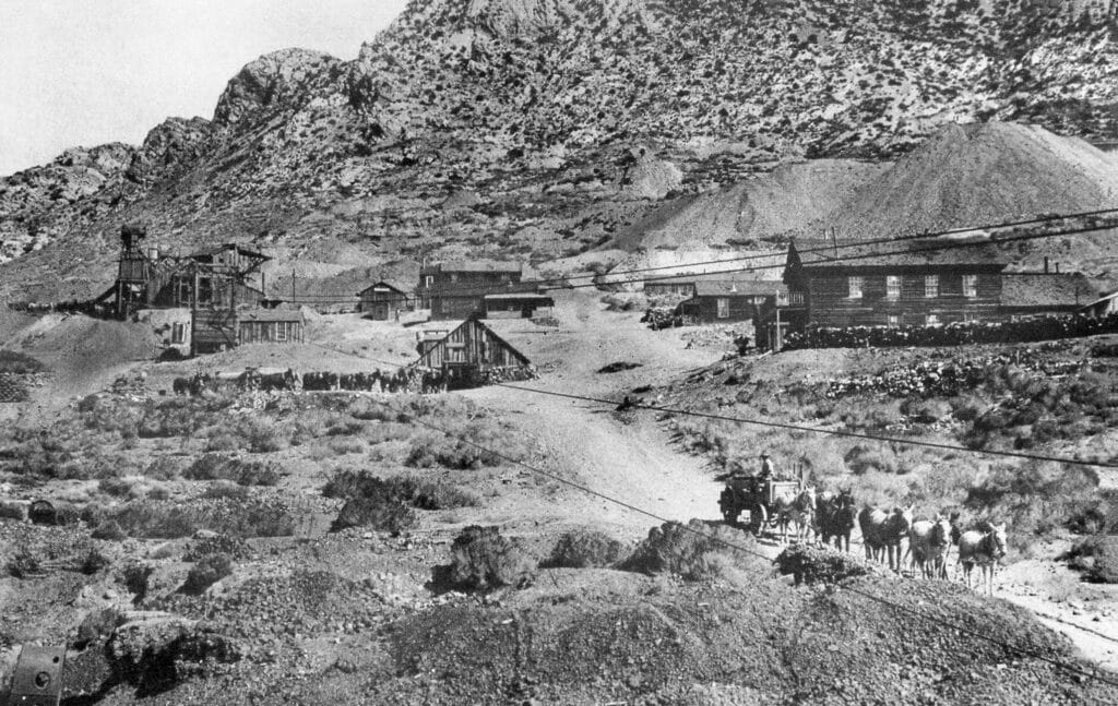
The Boom: 1878–1890
The peak of Beveridge production was the 1880s. By then, the district supported somewhere around 50 to 60 miners in the canyons, a post office, a grocery store, a saloon, and at least ten stone houses ¹¹. Two stamp mills — the McEvoy Mill in McElvoy Canyon and the Lasky Mill in Beveridge Canyon — processed ore from mines spread across multiple canyons. The Keynot Mine alone, by the time its early production period ended, had generated over a million dollars in gold bullion ¹² from workers who packed everything in on mules.
The logistics were a nightmare. No wagon road ever reached the district. A 1906 mining company report acknowledged that “a good wagon road” would make large-scale operations economical, but then admitted the terrain made such a road impossible ¹³. Every pound of machinery, every sack of flour, every section of water pipe had to come in on mule back. When things broke down, there was no quick fix. You were on your own.
One hundred and forty years later, nothing about that has changed.
The Decline and What Remains
By the 1890s, the boom had effectively ended. Production dropped, the mills went quiet, and the population of the canyons fell to a handful of individual operators. By 1898, a regional report on Inyo mining didn’t mention Beveridge at all ¹⁴.
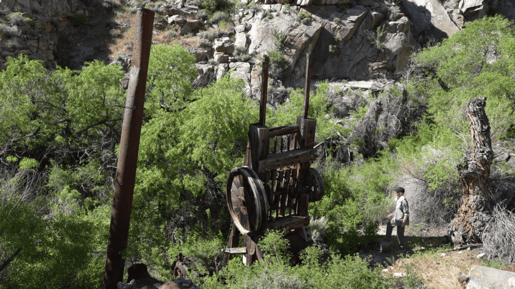
What the miners left behind when they finally walked out was everything they couldn’t afford to carry. The Lasky Mill — a five-stamp steam operation capable of crushing ten tons of ore per day ¹⁵ — is still standing in Beveridge Canyon, its stamps in place, its timbers weathered but largely intact. The Keynot Mine’s ore carts and tracks still stick out of the side of the mountain. The arrastra circles at Pat Keyes Canyon, the aerial tramway cables in Beveridge Canyon, the stone foundations of the McEvoy Mill — all of it is still there. The same inaccessibility that made the district brutally hard to work in its prime is precisely what has preserved it.
The Trail: What to Expect
Overview
The Lonesome Miner Trail is not an official route. It has no trailhead sign, no maintained tread, and no governing body. It’s a route stitched together from the historical mule trails, canyon drainages, and high ridges that the Beveridge miners used in the 1800s — surveyed, documented, and reconnected in the 1980s and 1990s by a core group of volunteers and BLM staff.
The name was given to the route by Wendell Moyer, a man whose entries still appear in the logbooks scattered along the way — with shockingly few names written after his. That detail alone tells you something about how often this trail gets walked.
The route runs north to south or south to north, starting on the Owens Valley side of the Inyos and dropping in and out of the deep canyons that drain east toward Saline Valley. Most people hike it in three to four days. The most common approach starts at the bottom of Pat Keyes Canyon, near the old Reward Mine. The most common exit is out Hunter Canyon into Saline Valley — which requires a car shuttle, or a friend willing to make a very long drive.
- Distance: 30–40 miles, depending on exact route
- Elevation change: 15,000–25,000 feet cumulative gain and loss
- Time: 3–4 days
- Difficulty: Strenuous to extreme
- Season: Late spring through early fall; high ridges can hold snow into June
Water
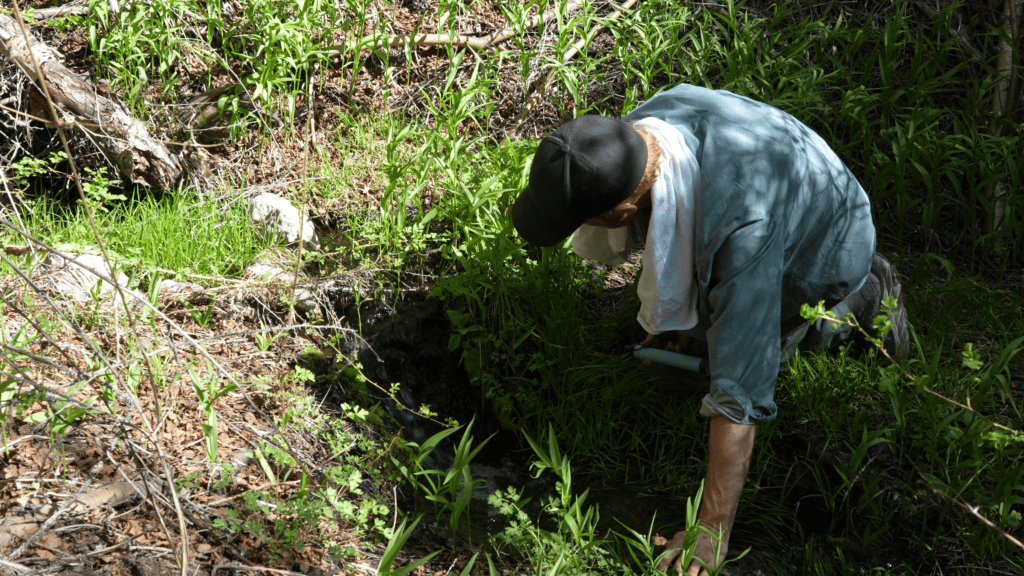
Water is generally available in the canyons throughout the route — Pat Keyes, the creek in McElvoy Canyon, sparsely near the Keynot Mine, and the year-round creek in Beveridge Canyon. But “generally available” is not the same as “reliably available,” and the gaps can be long. Treat all water. Carry more than you think you need. In dry years, springs that appear on older maps may not be running. Do your research before you go. Then carry more than you researched.
Navigation
The route requires a lot of trail-finding. In some sections, historical mule trails are visible. Some high ridges show game trails. But the lower sections in and out of the canyons are loose scree with no sign of the trail at all. A GPS locator is essential — not as a substitute for situational awareness, but as a backup for when (not if) the route disappears. Download tracks and maps from Gaia, CalTopo, OnX, or similar sources before you leave. Carry paper topo maps. You will have no cell service.
If you want the exact track I used, DM me on Instagram or email me.
Permits
No permit is currently required to hike the Lonesome Miner Trail. The route passes through BLM-managed Inyo Mountains Wilderness. Leave No Trace principles apply. Do not disturb archaeological sites — and there are many. The Beveridge Mining District is an active archaeological record, and removing artifacts, even small ones, is both illegal and genuinely destructive to our collective understanding of this place. Leave everything exactly as you found it.
A Note on Conditions
The canyons are primarily loose scree with exposed ridgelines. Weather changes fast. Lightning is a real problem on the high ridges. Rattlesnakes and the occasional mountain lion are problems in the canyons. This is not a casual outing. A warm-up trip into the area first wouldn’t hurt. Neither would telling someone where you’re going.
The Route, Day by Day
Day 1: Pat Keyes Canyon
The most common starting point is the bottom of Pat Keyes Canyon, accessed from Highway 395 near Lone Pine. The canyon is named for Patrick Keyes, an Irish miner who worked these hills from the late 1880s through the 1890s and became one of the most productive individual operators in the district’s history.
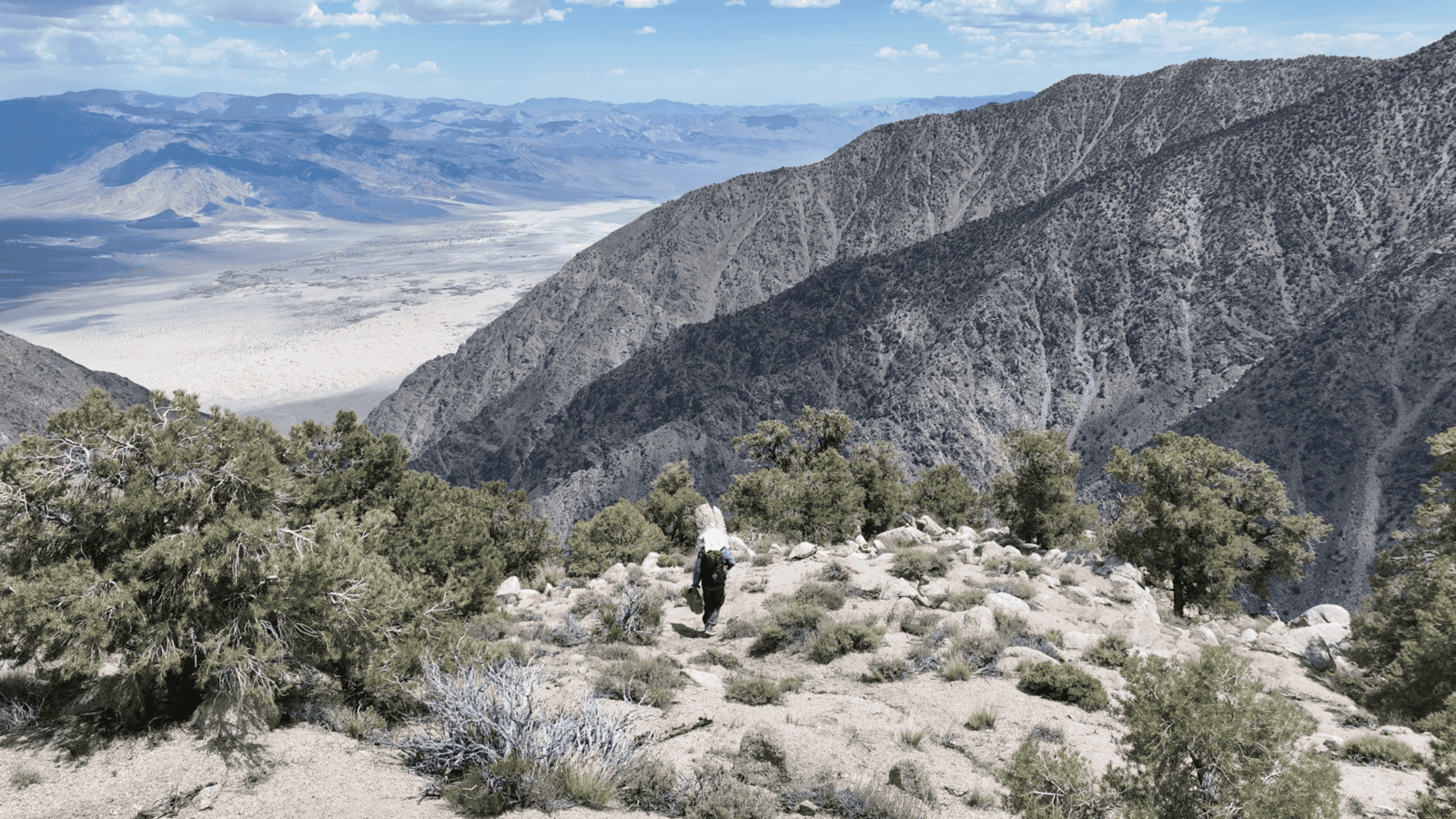
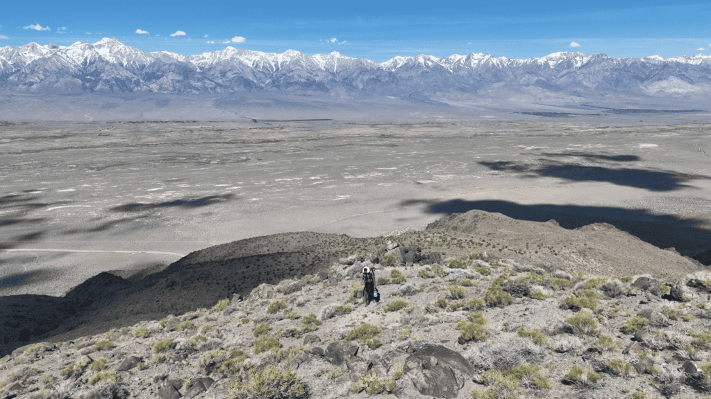
The grade up Pat Keyes is relentless, but manageable. The canyon is still relatively broad down low. You move through creosote and rabbit brush at the valley floor, through pinyon pine and juniper in the middle elevations, into mountain mahogany and scattered ponderosa as you climb. You probably won’t find a water source on your first day, so come prepared. By the time you reach the upper trail, you’re at roughly 8,000 feet, and the views back across Owens Valley toward the Sierra are extraordinary.
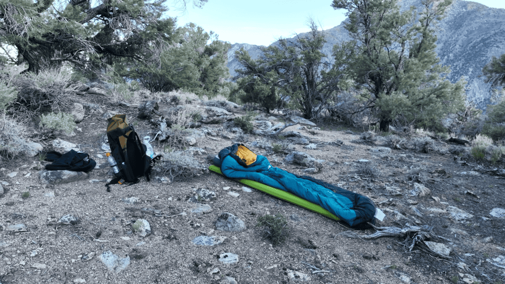
A good goal for Day 1 is to reach the upper ridgeline and follow it across toward the Saline Valley side. There’s a flat area that overlooks the canyon you’ll descend into the next morning. Get there, make camp, and rest up. Day 2 is a long one.
Day 2: Down (& Back Up) the Ridge into McElvoy Canyon
Day 2 gives you your first real taste of what the Inyos demand. You’ll drop into one canyon, climb back out, and drop into another — and by the time you make camp, you’ll have earned every foot of it.
From camp, the trail descends into Pat Keyes Canyon and your first reliable water source of the day. Take your time here and fill up — you won’t find water again until McElvoy. Just above the spring, the trail passes the remains of Patrick Keyes’ arrastra: a circle of flat stones, the perimeter still visible, where he would have thrown his ore and dragged a heavy stone around and around to grind it fine. In December 1895, that arrastra produced 113 ounces of gold from just ten tons of ore ¹⁶ — a yield of roughly eleven ounces per ton, at a time when five dollars per ton was considered workable.

Refill your water, rest your legs, and enjoy the canyon while you can — because the next order of business is climbing back out of it. The route navigates south to the crest separating Pat Keyes from McElvoy Canyon, and then drops. Hard.

The descent into McElvoy is approximately 3,000 feet in roughly a mile — steep, loose, exposed, and in places where the old trail has been entirely replaced by scree. Take your time. The canyon below will beckon, but a twisted ankle is no joke. You are now more than a day’s hike from any help. The canyon floor is not going anywhere.
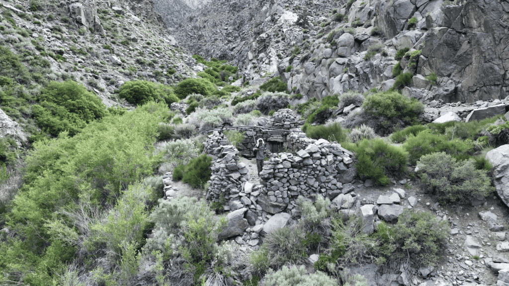
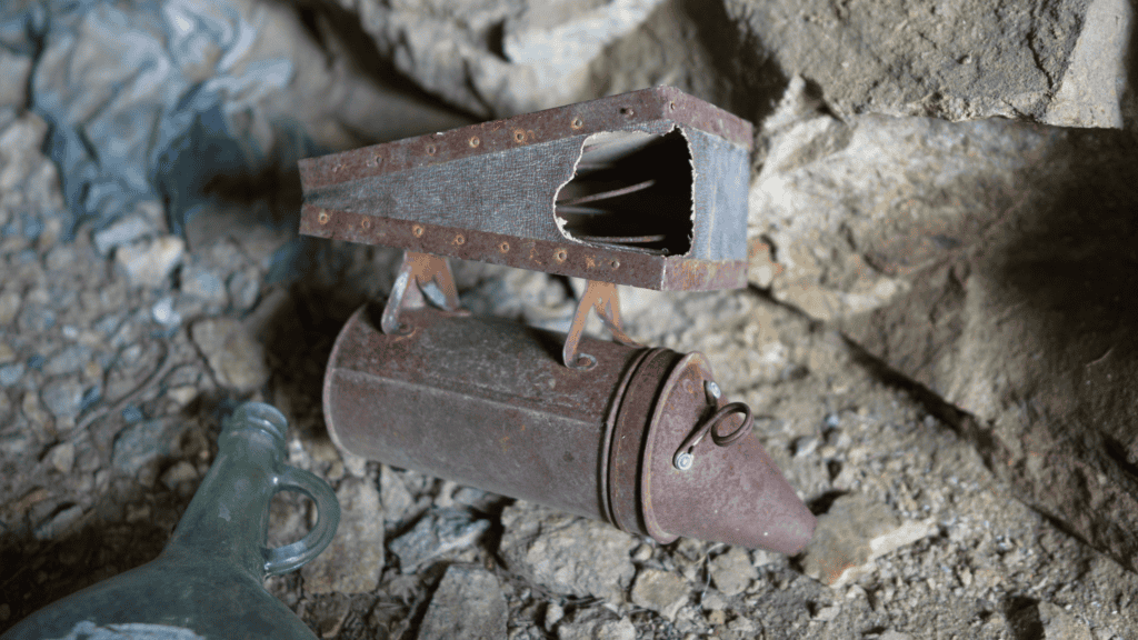
On the way down, just before you reach the bottom, you’ll come across something that stopped me cold the first time I saw it: a mineshaft fitted out as a home, with beekeeping equipment, clothes, tools, and a straw bed still on the floor. This is the part-time residence of my favorite character in the entire Inyo Mountains — Marion Howard, the Beekeeper of McElvoy Canyon.
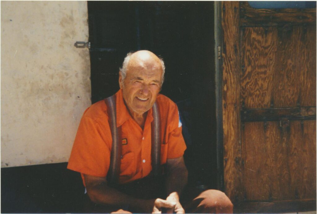
Marion Howard — The Beekeeper of McElvoy Canyon
In the 1980s, a group of hikers approaching McElvoy Canyon from the Saline Valley side discovered something they weren’t expecting: a series of waterfalls, some 100 to 200 feet high, with handmade ladders of twine and wood ascending straight up the rock faces. Above the waterfalls were huts equipped with beekeeper’s helmets, nets, smokers, and wooden honeycomb frames. Someone had been keeping bees in McElvoy Canyon, miles from the nearest road, accessible only by a brutal mountain approach or by climbing a series of improvised ladders up a waterfall.
The mystery was eventually resolved. The beekeeper’s name was Marion Howard. He had grown up in the East, working at Chrysler, and at some point in the 1960s decided he wanted something different. He began making solo trips into McElvoy Canyon from Lone Pine, carrying everything in a canvas duffel sack — hiking from 3,500 feet over an 11,000-foot pass and back down to the canyon floor, never with a pack animal, never with a partner. He built the huts. He constructed the ladders. He kept his bees.
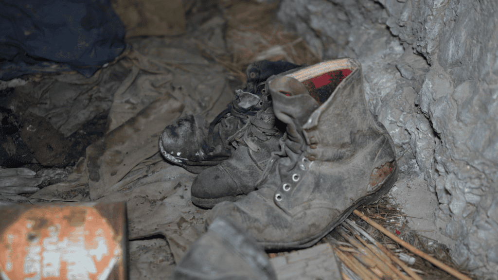
His mineshaft is still there, exactly as he left it. The canvas duffel is still inside. The clothes are still in the duffel. The smoker sits on the shelf. The beekeeper’s net hangs on a hook. The straw he used as a bed is on the floor. I’ve been in a lot of abandoned places in the Inyos, and this one still gets me.
Below the mineshaft, the canyon opens into something you’d never guess was down here from the ridgeline above. Waterfalls. Wildflowers. Ferns. The sound of running water echoing off the walls. After the exposure and loose rock of the descent, it hits you like a different world entirely — and it did exactly that to me the first time I came through.
At the canyon floor, the stone walls of the McEvoy Mill come into view — the first stamp mill built in the Beveridge District, back in the 1880s ¹⁷. The foundations are still standing. It’s a good place to make camp for Night 2, and after the day you’ve just had, you’ll be glad to stop moving.
Day 3: The Keynot Mine & Beveridge Ridge Cabin
McElvoy Canyon has a way of making you want to stay. Don’t. More history and more hard hiking are ahead of you, and Day 3 delivers what most people come for.
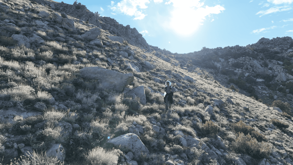
The trail out of McElvoy is where the route earns its reputation for being hard to follow. It’s at its faintest here — you’ll spend as much time route-finding as walking, picking your way up from the canyon floor to the ridge separating McElvoy from Keynot Canyon. It’s a steep, relentless gain to start the morning, and the terrain doesn’t give you much to work with. Go slow, look ahead, and trust your GPS when the ground tells you nothing.
Once you crest the ridge, Keynot Canyon opens below you, and you begin the descent toward the most historically significant site on the entire trail.
The Keynot Mine
The Keynot Mine is the reason the Beveridge Mining District exists. Discovered in 1878 and worked through multiple ownership changes, it produced over a million dollars in gold before 1906 ¹⁸ — extracted entirely by hand, packed out entirely on mules, from a site with no road access and no margin for error. The underground workings eventually totaled over 10,000 feet of levels, sublevels, and raises ¹⁹.
It was worked again as recently as 1983, when a company called Far West Exploration helicoptered in a 250-ton-per-day cyanide recovery plant and attempted to rework the old ore dump ²⁰. I’ve spoken with miners who were part of that operation. By all accounts it was a disaster from the start — equipment failures, cyanide spills that killed wildlife in the canyon, and a timeline that collapsed in under a year. The company walked away and left everything where it sat. It is, in some ways, a very familiar story up here.
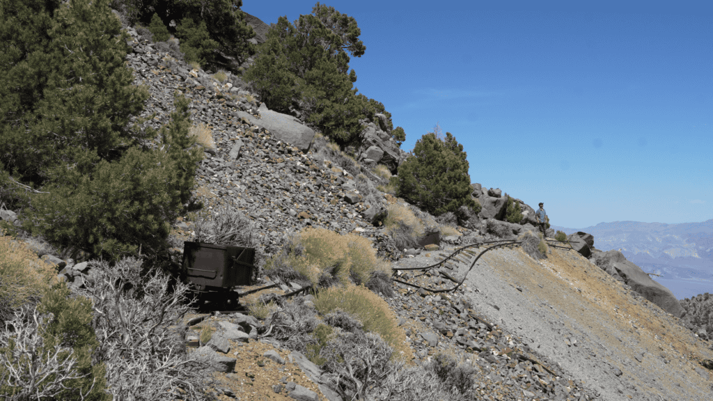
You’ll encounter the mine in two distinct layers. Coming down into the canyon, you’ll first reach the original workings: stone cabins, ore track with carts still sitting on the rails, and a massive tailings pile that you’ll scramble down to reach the newer operation below.
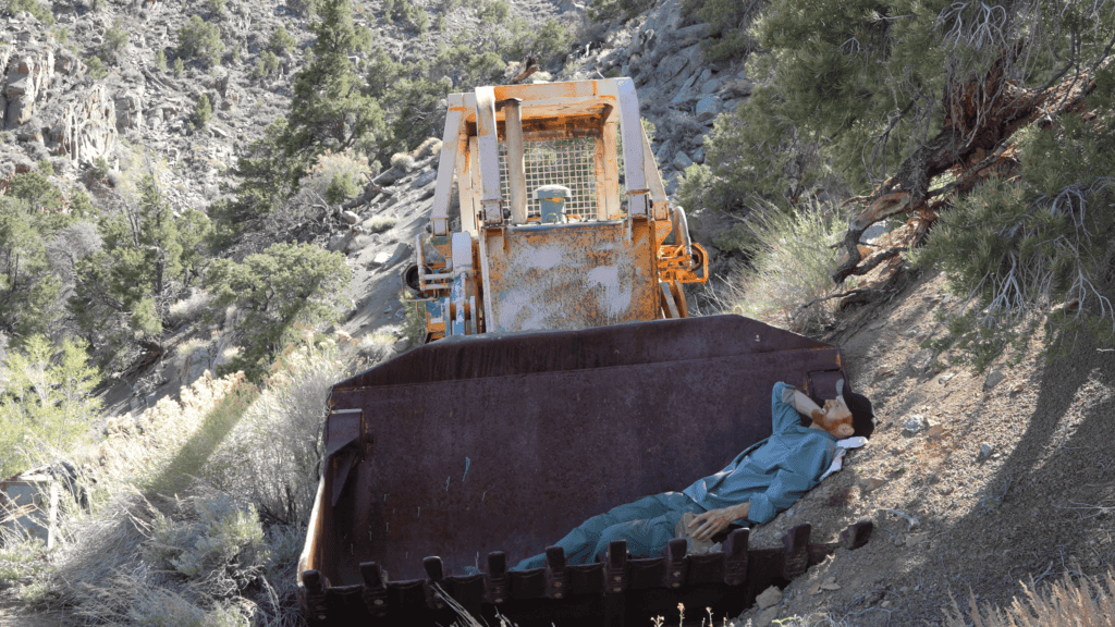
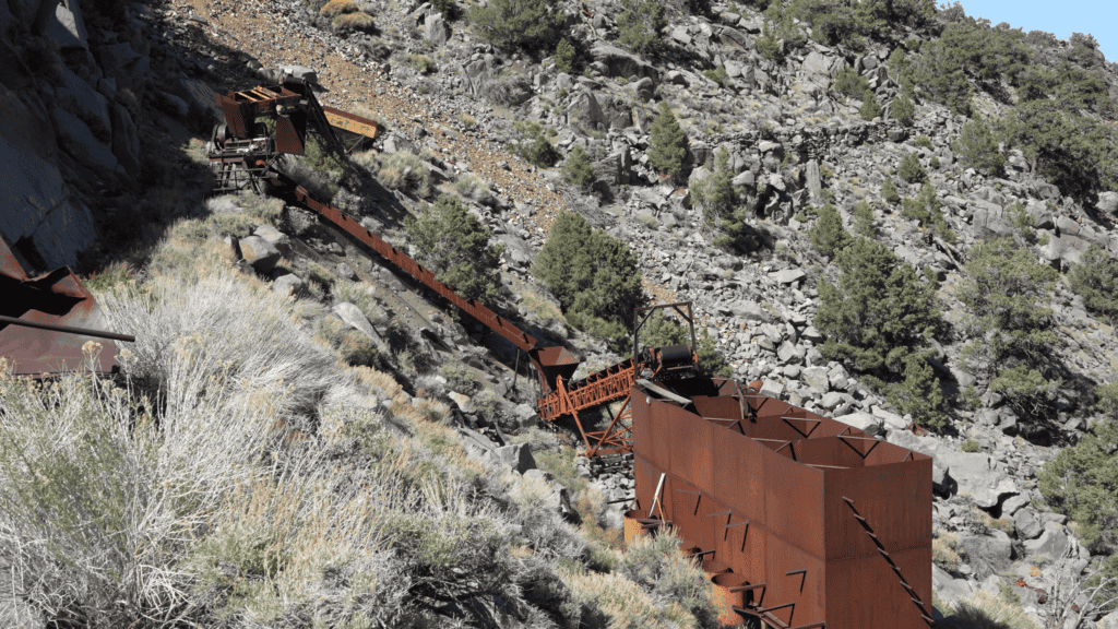
And then the 1983 debris field comes into view. Cyanide tanks. A bulldozer slowly rusting into the ground. Conveyor belts with their drive belts still attached. A Caterpillar D8800 generator. A crucible and commercial furnace. All of it flown in piece by piece, welded together on-site at enormous expense, and abandoned when the money ran out. There’s no practical way to remove any of it now without cutting it apart first. It may be there longer than the original mine workings.
It’s a strange place — a century of ambition layered on top of itself, both eras having failed in roughly the same way, for roughly the same reasons. Worth spending some time here before you push on.
The Beveridge Ridge Cabin
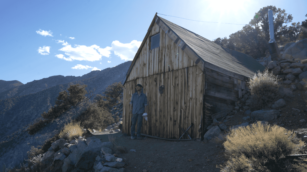
From the Keynot Mine, the route climbs one final ridge — the spine separating Keynot Canyon from Beveridge Canyon. At the top, at around 9,000 feet, there’s a stone cabin waiting for you. The Beveridge Ridge Cabin has a fireplace, beds, a bighorn sheep skull on the wall, and a view that will make you forget how hard the last three days were.
It served as a waystation between the two canyons during the mining era. It still does.
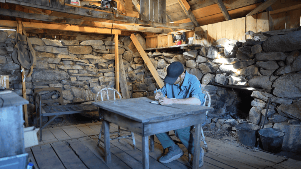
Inside, there’s a guest book. Flip through it and you’ll find an entry from Wendell Moyer — the man who did more than anyone else to stitch the Beveridge Mining District’s old mule trails into the continuous route you just walked. There aren’t many names written after his. There’s something quietly humbling about that.
If you’ve kept a decent pace through Day 3, you’ll reach the cabin with enough time to make dinner, rest your legs, and watch the sunset paint the canyon below — the canyon you’ll drop into tomorrow. The one with more history still sitting in it than anywhere else on the trail. A place that’s been called the most remote ghost town in America.
Beveridge.
Day 4: Beveridge Canyon
By Day 4 your legs know exactly what they’ve been through. The descent from the cabin into Beveridge Canyon will remind them one more time — it’s a significant drop to the canyon floor, and after three days in the Inyos, your knees will feel every foot of it. But what’s waiting below is the reason you came.
Beveridge is not really a ghost town in the way that phrase usually gets used. There was no main street, no town square, no saloon with a mirrored bar. What there was, starting in the late 1870s, was a loose collection of stone cabins, canvas tents, and stamp mills strung out over a mile and a half of one of the steepest canyons in California — built by men who had no choice but to construct everything from local rock, because there were no wagon roads in and there never would be.
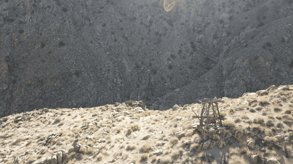
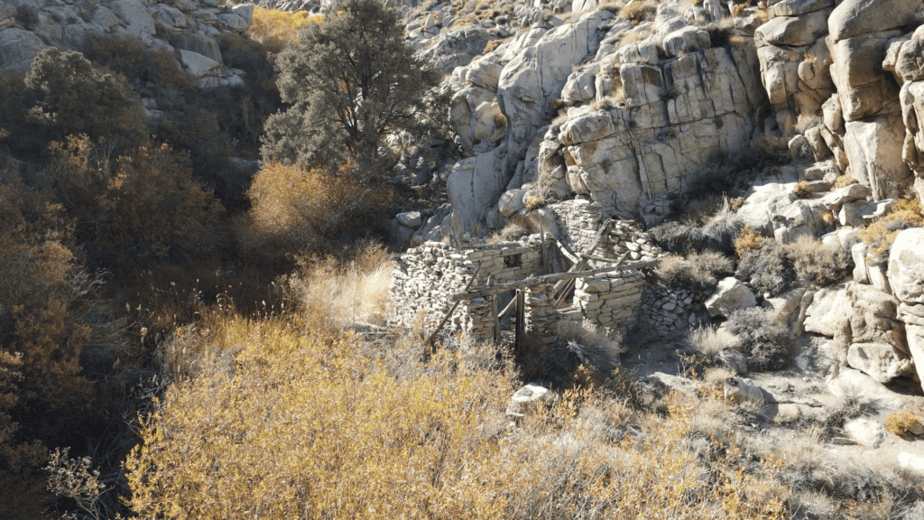
At its peak in the early 1880s, the district employed perhaps 150 men and produced over a million dollars in gold. The five-stamp Lasky Mill that processed it — 750-pound iron stamps driven by a steam engine built in Portland, Connecticut — is still standing ²¹. The stamps are still in place, exactly where they stopped, more than a century ago. Next to them: a cookhouse, an assay office, stone cabins with niche shelves still built into the walls. Walnut trees and iris planted by miners who wanted something living around them ²². An aerial tramway whose ore buckets still hang from the cables strung above the canyon floor ²³.
It is the most intact ghost town in California. It is also almost certainly the hardest one to reach — which is the only reason any of it is still there.
The canyon has a year-round creek running through it, flanked by willows, wild rose, and mint. It also has rattlesnakes, so watch where you put your hands when you’re scrambling around the old structures.
Spend as much time here as you can before you have to move. Walk the full length of the canyon. Look into the cabins. Find the tramway towers. Check the rafters — previous visitors have found three leather-bound volumes of Shakespeare up there, inscribed “Virginia Twigg / New Harmony, Indiana / 1896” ²⁴, along with a Victor Records catalogue and account ledgers from 1916, 1917, and 1919 ²⁵. These are not the artifacts of men who left civilization behind. They’re the artifacts of men who carried it with them — all the way up here, with infinite toil.
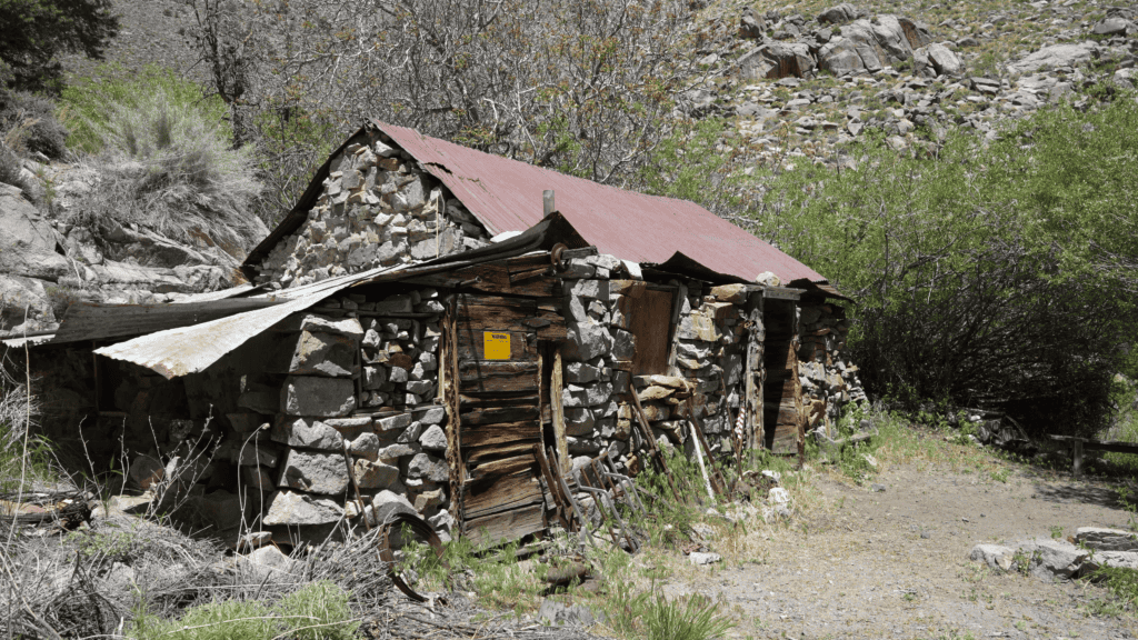
When you’re done with the townsite, head up canyon to a cabin known as Frenchy’s — a beautiful stone structure perched above the stream, half-hidden by trees, with reliable year-round water. Inside there are bunk beds, a cooler with a logbook in it, and whatever provisions previous hikers have seen fit to leave behind. It’s a good place to rest before the final push out.
From Frenchy’s, most people make their way down to the Bighorn Mine, Bighorn Spring, and Bighorn Cabin before exiting to Saline Valley Road — and when the light tells you you have to go, that’s the way out, with hopefully your shuttle waiting at the end of it.
A note on my own route: since I was returning home to Cerro Gordo, I climbed out via New York Butte rather than continuing down to Bighorn. I’ll update this section once I’ve completed that stretch — but everything from the townsite to Frenchy’s is as described above, from my own boots on the ground.
Closing Thoughts
The Lonesome Miner Trail is hard. It’s brutal. At times it can be dangerous. It doesn’t reward casual interest — it rewards the kind of person who reads 140-year-old newspaper archives and wonders what those canyons actually look like. Who wants to experience something very far removed from any other person. If that’s you, this is your trail.
What stays with me, months after completing the traverse, isn’t any single view or any single artifact. It’s the cumulative weight of the place — the feeling that builds over four days of walking through terrain that has barely changed since the men who built it first set foot here. The arrastra circle where Keyes ground his ore. Marion Howard’s net hanging on its hook. The Shakespeare in the rafters. The stamps sitting exactly where they stopped.
These canyons were worked with “infinite toil” by people who had no guarantee any of it would amount to anything. Most of it didn’t, in the end. The mines closed, the mills went quiet, and the mountains slowly began to take it all back. But the mountains also preserved it — kept everything in a kind of suspended animation that no maintained trail, no visitor center, no interpretive sign could replicate. The inaccessibility that made this place so hard to work is the same inaccessibility that kept it intact. The Inyos protected their own secret.
Go while it’s still like that. Leave it the way you found it. And if you make it to Beveridge and find yourself standing next to those stamps in the afternoon light, trying to understand how any of it got there — know that you’re asking exactly the right question, and that the Inyos are indifferent to the answer.
The mountains were here before the miners. They’ll be here long after the rest of us, too.
PS. If you’re interested in a full video about hiking the Lonesome Miners Trail, I recorded my first traverse here.
PPS. If you’re interested in a canyon just beond the Lonesome Miners Trail with equal history, check out Craig Canyon.
Key Sites: A Quick Reference
| Site | Canyon | Elevation | Period | What’s There |
|---|---|---|---|---|
| Pat Keyes Arrastra | Pat Keyes | ~7,500 ft | 1887–1899 | Stone grinding circle near spring |
| McEvoy Mill | McElvoy | ~5,300 ft | 1881–1894 | First stamp mill; stone foundations |
| Marion Howard’s Camp | McElvoy | ~5,500 ft | 1960s–90s | Beekeeper camp; 1970s/1980s artifacts |
| Keynot Mine Complex | Keynot | ~8,000 ft | 1878–1983 | 10,000 ft workings; 1983 helicopter plant |
| Beveridge Ridge Cabin | Ridge | ~9,000 ft | 19th–20th c. | Wood waystation; guest book; bighorn skull |
| Big Horn Mine | Hunter | ~7,000 ft | 1877–1930s | Steam arrastra; founding site of district |
| Frenchy’s Cabin | Beveridge | ~5,800 ft | 1916–1919+ | Walnut trees and iris; account ledgers |
| Lasky Mill | Beveridge | ~5,600 ft | 1883–1899 | Five stamps virtually intact; 24,000 oz gold |
| Aerial Tramway | Beveridge | Various | 1880s–1900s | Cables and towers still visible |
Practical Information
Trailhead: Bottom of Pat Keyes Canyon, off Highway 395 near Lone Pine, CA.
Exit: Beveridge Canyon to Saline Valley Road. Car shuttle required.
Maps: USGS 7.5-minute quads: Waucoba Wash, Jackass Canyon, Craig Canyon, New York Butte. Download a GPS track before you go.
Water: Springs in Pat Keyes Canyon, McElvoy Canyon creek, near Keynot Mine, and Beveridge Canyon creek. Treat all sources. Carry capacity for dry camps.
Permits: None required as of this writing. BLM Inyo Mountains Wilderness.
Contact: BLM Bishop Field Office, (760) 872-5000.
The Beveridge Mining District is an active archaeological record. Do not disturb or remove any artifacts. Even seemingly minor disturbance is illegal and contributes to the loss of irreplaceable historical information.
References
¹ Inyo Independent, 30 December 1882.
² Swope, Karen K., With Infinite Toil: Historical Archaeology in the Beveridge Mining District, Inyo County, California (1993).
³ Inyo Independent, 3 July 1880.
⁴ Close, Terry J., Mineral Resources of the Inyo Mountains Wilderness Study Area, U.S. Bureau of Mines (1985), p. 19.
⁵ Knopf, Adolph, A Geologic Reconnaissance of the Inyo Range and the Eastern Slope of the Southern Sierra Nevada (1918), p. 109; Chalfant, W.A., The Story of Inyo (1933), p. 277.
⁶ Swope, Karen K. (1993), p. 85. (Archaeological assessment of pre-American arrastras).
⁷ Daily Bodie Standard, 2 December 1879.
⁸ Beveridge Mining District organization records, 7 December 1877.
⁹ Beveridge Mining District organization records, 7 December 1877.
¹⁰ Inyo Independent, 18 May 1878.
¹¹ Flint, Arthur, A History of the Beveridge Mining District (1941), pp. 6-7.
¹² Keynote Mining and Milling Company, unpublished company report (1906).
¹³ Keynote Mining and Milling Company, unpublished company report (1906).
¹⁴ Inyo Independent, 17 June 1898.
¹⁵ Close, Terry J. (1985), p. 79.
¹⁶ Inyo Independent, 6 December 1895.
¹⁷ Archaeological site record for Locus 31 (McEvoy Mill), CA-INY-4395H.
¹⁸ Keynote Mining and Milling Company, unpublished company report (1906).
¹⁹ Close, Terry J. (1985), p. 27.
²⁰ Close, Terry J. (1985), p. 26.
²¹ Close, Terry J. (1985), p. 79; site observation of “THE PICKERING/PORTLAND. CONN./GOVERNOR” nameplate.
²² Site observation of Locus 41 (Frenchy’s Cabin).
²³ Site observation of Trenton Iron Company buckets (Pat. 1897) at Locus 44/46.
²⁴ Inscription in recovered volumes, currently held in regional collections.
²⁵ Eastern California Museum collections (1916-1919 ledgers and 1964 donations).