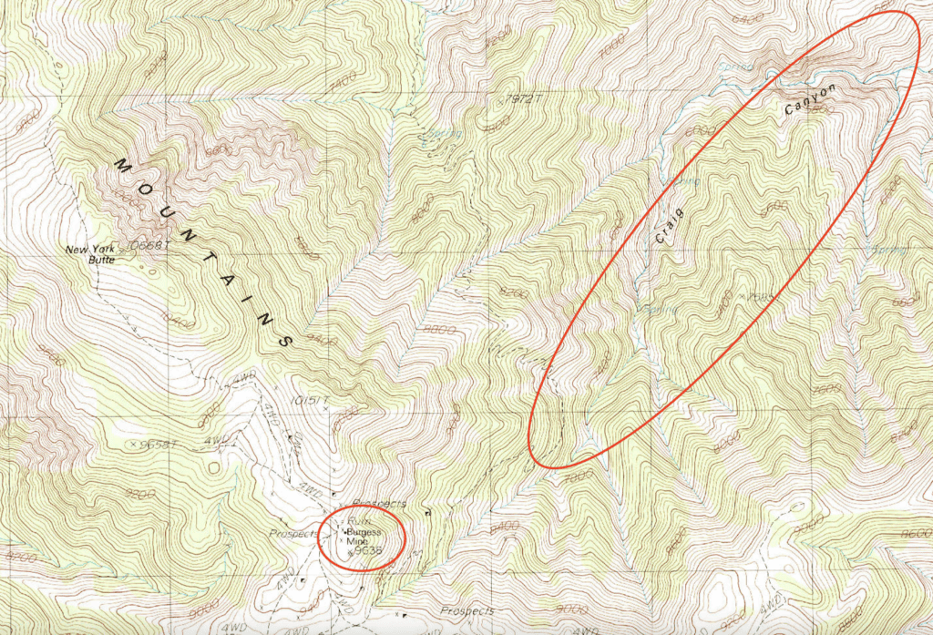
Craig Canyon is one of the most remote and least-visited hikes in the Inyo Mountains, just outside Death Valley. Hidden at the bottom is a five-stamp mill from the 1880s—one of the few still standing in such an inaccessible location. This guide covers the history, route, and what to expect if you attempt the hike.
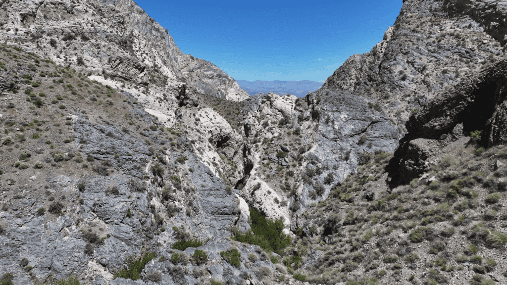
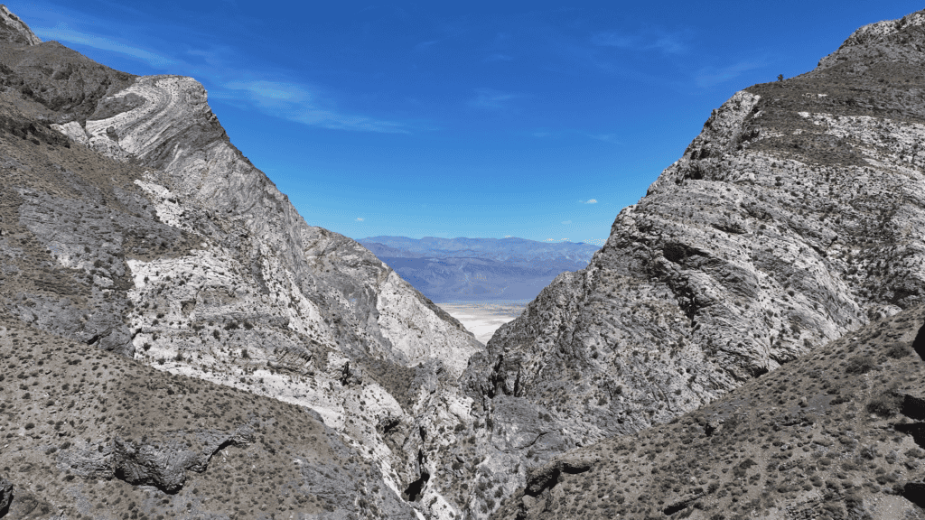
There is a canyon in the Inyo Mountains that almost nobody visits. No maintained trail leads into it. No signs mark its entrance. It drops from around 10,000 feet to 1,500 feet in five horizontal miles, a brutal plunge through cliffs and talus that makes casual hiking effectively impossible. A handful of people make their way there each decade—if that.
Its name is Craig Canyon, and if you’re reading this, you’re probably one of the few people curious enough to go looking for it.
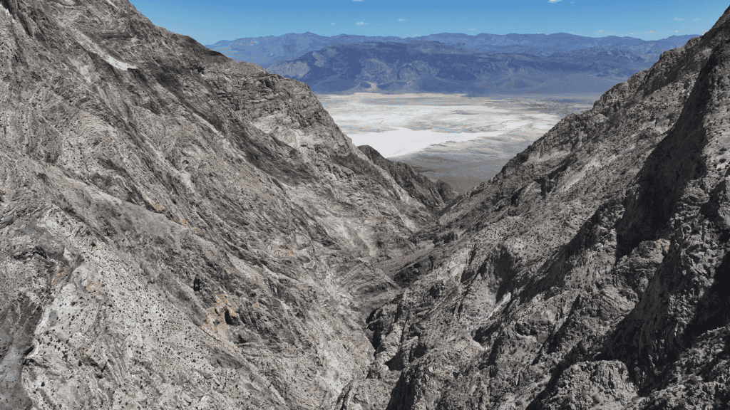
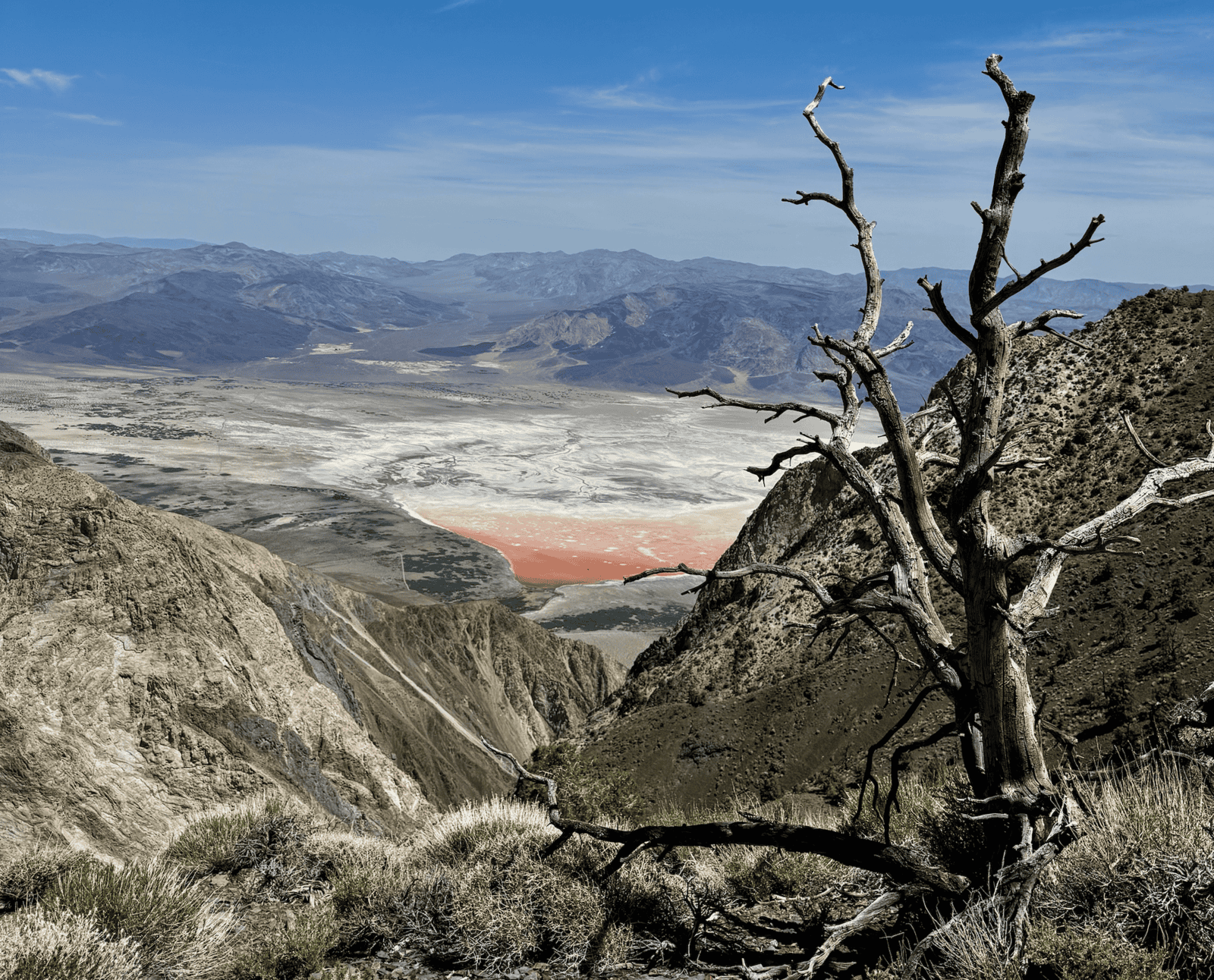
The Inyo Mountains sit just across the Owens Valley from the Sierra Nevada — across from Mount Whitney, the Pacific Crest Trail, and all the well-mapped wilderness that draws crowds every summer. The Inyos are something else entirely. Rugged, remote, and unforgiving, they press hard against Death Valley National Park on their eastern flank. A series of steep canyons drop thousands of feet in just a few miles, cut through with cliffs that make casual hiking nearly impossible. For that reason, they’re almost never visited.
But in the 1870s and 1880s, miners found their way in any way. They pulled an estimated 38,000 ounces of gold and 39,000 ounces of silver out of these canyons — nearly $100 million worth at today’s prices, extracted by hand from rock that I struggle to simply walk past. They built mills, cabins, and mine shafts in places that defy comprehension. Most of those sites are slowly being reclaimed by the desert. Some are looted by treasure hunters. Craig Canyon is one of the least disturbed of all of them.
Quick Facts
- Location: Inyo Mountains, California
- Elevation Range: ~10,000 ft to ~1,500 ft
- Elevation Loss: ~8,000+ ft
- Distance: ~8 miles (one way)
- Difficulty: Extreme
- Trail: None
- Water: Seasonal/perennial stream
- Best Time: Spring / Fall
What’s Down There
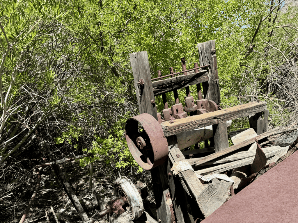
At the bottom of Craig Canyon, beside a year-round stream, there’s a five-stamp mill that has been standing since approximately 1880. It was built to process ore from the American Flag Mine, a small operation that ultimately yielded around 100 ounces of gold and 500 ounces of silver. The mill needed water to run, which is why the miners went to the extraordinary effort of dragging ore down into the canyon rather than processing it at the mine above. Every piece of steel had to come over an 11,000-foot pass by mule, then get lowered down the canyon walls on wooden skids.
A newspaper reporter who visited the area in 1880 wrote that the canyon walls in the area were so vertical they were “inaccessible to anything without wings.” Another called the district “grand, gloomy, and gorgeous.” Both descriptions still hold.
Alongside the mill, you’ll find a year-round stream with deep, clear pools, thick riparian vegetation, and several stone cabins whose walls have somehow survived intact for over a century. It is, by any measure, a remarkable place — made more so by how few people ever see it.
The History
The American Flag Mine was part of the Beveridge Mining District, officially organized in 1877. The district is named after John Beveridge, a mining partner of William L. Hunter — the man who organized much of the transport and supply operation for the mines in this range. Getting supplies into these canyons was a serious logistical undertaking. The nearest railroad stop was Keeler, a small town at the base of the mountains about fifteen miles away as the crow flies, but a full day’s journey by mule over the pass. Everything — every nail, every can of lard, every piece of machinery — came through Keeler first.
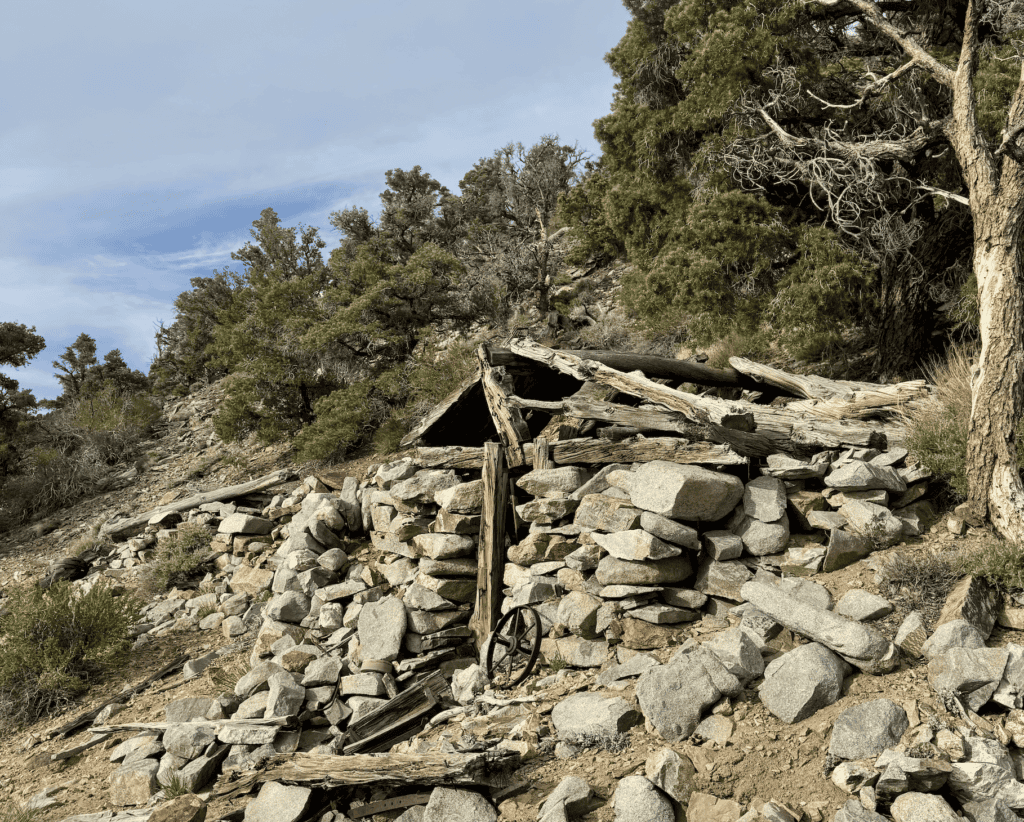
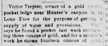
Just above Craig Canyon, on the ridge, sits the Trepier Mine. Victor Trepier was a classic “pocket miner” who worked these cliffs in the 1890s, not chasing massive veins but hunting for small, intensely concentrated pockets of gold. In June 1894, he walked into the nearby town of Lone Pine and told a reporter he’d just hit a pocket with three ounces. After a month on that cliff face, he walked out with fourteen ounces of pure gold in his pockets. Most miners weren’t so lucky. One reporter noted that a camp just over the ridge from Craig Canyon got exactly one hour of sunshine a day in winter. You were freezing in the dark, dragging rock out of a hole, hoping for a break that usually never came.
How to Get There
Hiking into Craig Canyon is not casual. If you go, go prepared.
The most direct route starts near New York Butte or the Burgess Mine, at around 10,000 feet in elevation. The mill sits below 5,000 feet (at ~4,815ft) — meaning you’ll lose more than 5,000 feet of elevation over just a few miles, much of it on loose, unstable scree with no trail.
If you are just attempting to go to the mill, and not see the full canyon, then follow the Southern ridge of the canyon toward the Trepier Mine.
On my first attempt I made it to the Trepier Mine and turned back. The scree below it was too loose and the angle too steep to navigate comfortably without more preparation. On my second attempt I made it through, but it took several hours of careful scrambling.
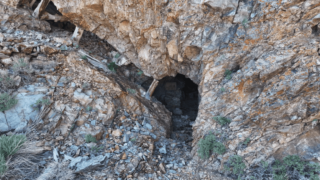
Once you drop below the Trepier Mine, you’ll pass through the prospects — a series of small excavations that still contain old wooden boxes and equipment. One box is stamped “E.B.H., Keeler, Cal.” — almost certainly a local merchant or freighter who was the last link in the supply chain before the mountains swallowed everything. From there, it’s more scree until the canyon floor opens up and the stream appears.
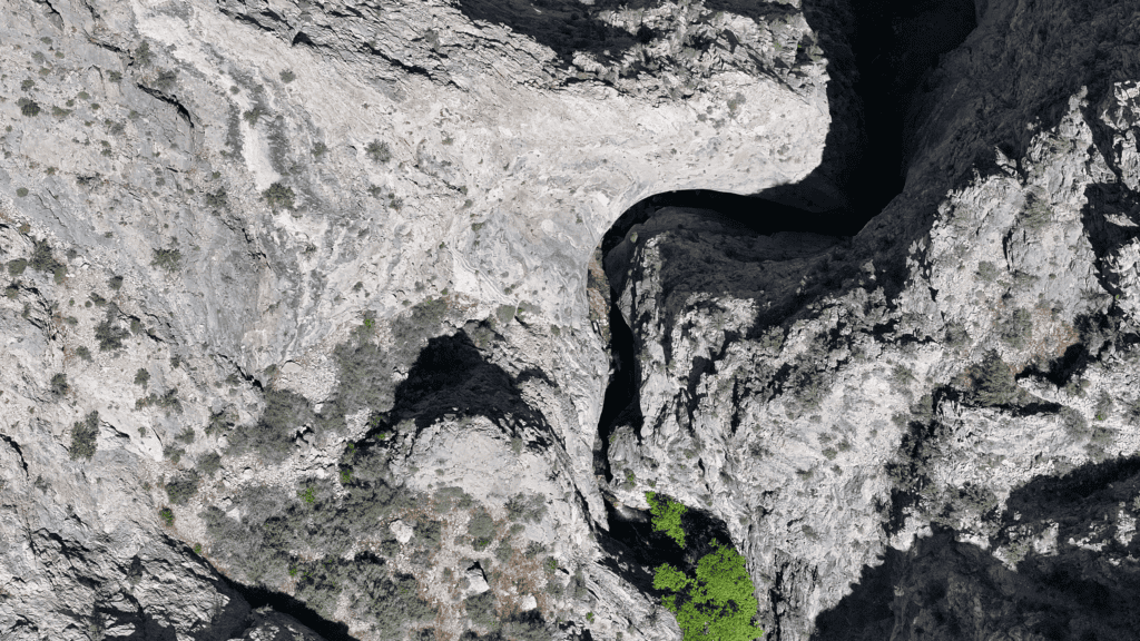
Beyond the mill, the canyon tightens into the Narrows — walls pressing to within six feet of each other while rising hundreds of feet overhead.
If you skip the rappels required for the Narrows, the hike out is brutal. Plan for two thousand to twenty-five hundred feet of loose scree climbing before you hit solid ground again around 7,200 feet, followed by a long walk back to the butte. Start early, bring more water than you think you need, and don’t underestimate the descent.
One More Thing
Inside one of the stone cabins at the bottom of the canyon, there’s a glass bottle.
Inside the bottle is a business card belonging to Steve Smith—a BLM ranger and Inyo Mountains explorer who wrote a trail report about Craig Canyon in 1992, one of the only documented accounts of the place.
His report is what led me here in the first place.
I left the card where I found it. It felt like the right thing to do.
If you make it down there, send me a photo!
PS. If you’re looking for similar hikes, the Lonesome Miners Trail is the cream of the crop when it comes to historic Inyo Mountains hikes.
More Photos