The Inyo Mountains are one of the most remote and least-visited mountain ranges in California, located between Owens Valley and Death Valley. Known for their extreme terrain, abandoned mines, and lack of maintained trails, they offer some of the most challenging and historically rich hikes in the American West. This guide covers the hikes, history, and hidden places of the Inyo Mountains – including locations like Craig Canyon, Beveridge, and McElvoy Canyon.
When you stand in the Owens Valley and look east, you see a wall of rock that almost doesn’t look real. To the west, the Sierra Nevada gets all the glory – paved roads, the Pacific Crest Trail, national parks, and millions of visitors.
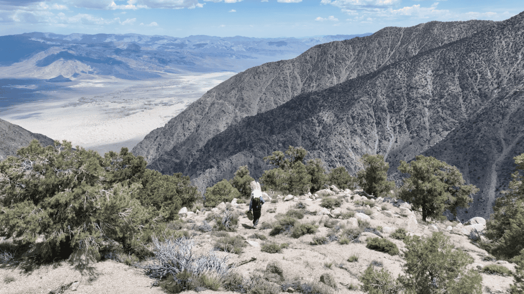
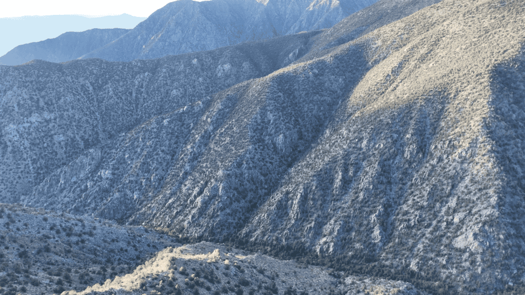
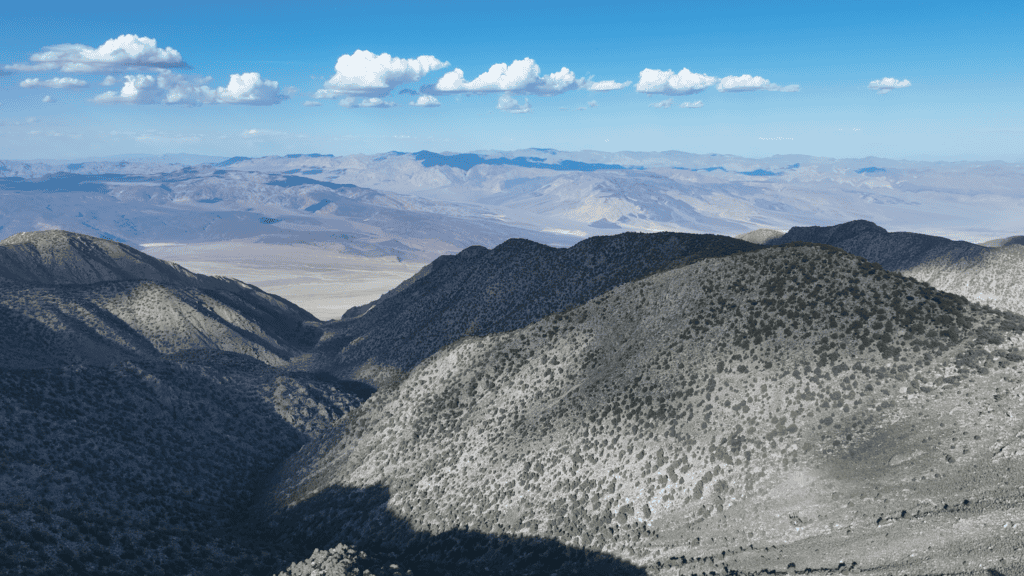
But the Inyo Mountains sit mostly ignored. A jagged, 70-mile stretch of peaks rising to over 11,000 feet in just a few horizontal miles – making it one of the steepest and most rugged mountain ranges in North America.
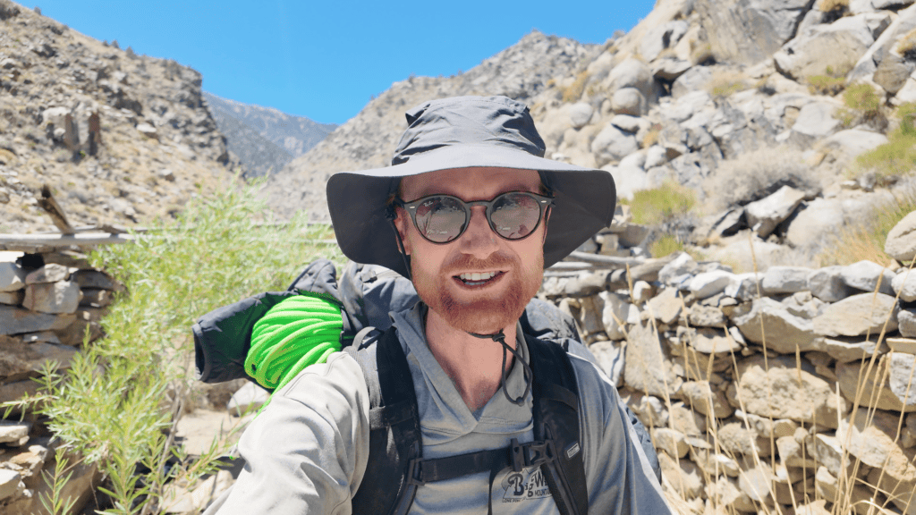
I live in the Inyo Mountains, in the old silver mining town of Cerro Gordo – once the largest silver mine in California. For the past six years, I’ve spent countless hours hiking through this range, trying to understand what’s hidden inside it.
Because while the Inyos can feel nearly impossible to move through these days, they weren’t always empty. They’re a graveyard of human ambition. A place where miners dragged steam boilers over 11,000 ft ridges and built aerial tramways across bottomless canyons – all in the pursuit of silver and gold. A place where a man named Marion Howard walked away from his job at a Detroit auto plant and chose to live alone in a stone hut, raising bees beside a waterfall.
A place where an 1880 newspaper described the canyon walls as “so nearly vertical… as to be inaccessible to anything without wings.” 1
And where men went anyway.
There are casual mentions of these places in the history books – the Keynot Mine, Big Horn Mine, Beveridge, Pat Keyes – and each of them was a big deal in its own time. But they’ve mostly been lost to history. My hope, in exploring them and writing about them, is to bring them back to life a little. To help piece together the historic puzzle that is the Inyo Mountain range.
This is the definitive guide to the Inyo Mountains – the hikes, the history, the abandoned mines, and the hidden places that most people will never see.
Quick Facts
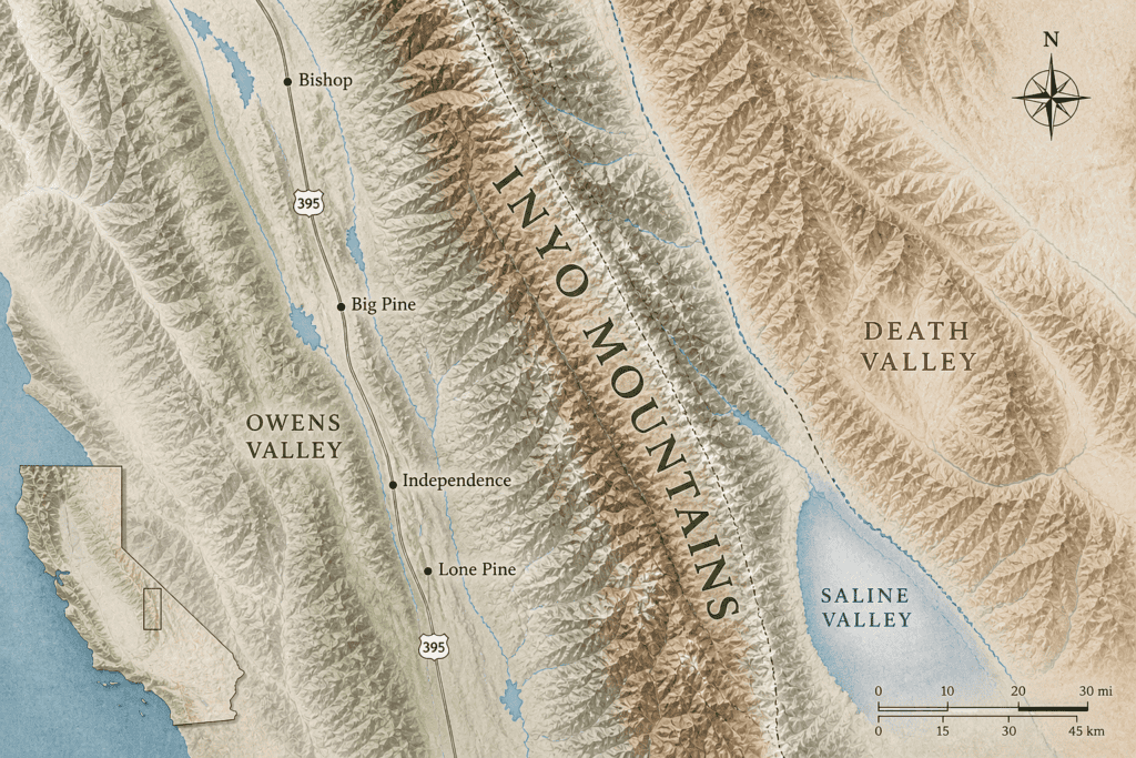
Location: Eastern California, between Owens Valley (west) and Saline Valley / Death Valley (east)
Highest Peak: Waucoba Mountain, 11,123 ft 2 in the southern range
Range Length: ~70 miles north to south
Terrain: Steep fault-block mountains, deep narrow canyons, loose scree, fractured metamorphic and granodioritic rock
Trails: Almost no maintained trails – route-finding and cross-country travel are mandatory
Water: Extremely scarce. A few perennial springs exist in specific canyons (McElvoy, Pat Keyes, Craig), but they are not guaranteed
Best Time to Visit: Spring (March–May) and Fall (October–November). Summers are dangerously hot. Winters bring snow and sub-zero temperatures to the passes
Difficulty: Extreme. High physical fitness, navigation skills, and a tolerance for unstable footing and total isolation are required
Land Management: Bureau of Land Management (Inyo Mountains Wilderness); Inyo National Forest
What Makes the Inyo Mountains Unique
The Anti-Sierra
The best way to understand the Inyos is to contrast them with the Sierra Nevada just across the valley. The Sierra is a granite playground – solid rock, alpine lakes, well-graded switchbacks, and a massive infrastructure of permits and search-and-rescue teams.
The Inyos are the opposite.
The rock here is metamorphic and sedimentary, fractured by fault lines and baked by the desert sun. It crumbles underfoot. There are no signs, no trailheads, and very few people. When you step off the dirt road in the Inyos, you’re on your own.
The isolation carries a psychological weight that you don’t feel in ranges where you know another hiker will pass within the hour. I’ve cumulatively hiked for hundreds of days in the Inyos, and have never run into another person.
The Sierra has a gradual western slope that allows gentle approaches from the coast. The Inyos have no such luxury. They rise almost vertically from the valley floor – a wall with no gentle entry points. You either climb straight up, or you don’t go at all.
The Geology: Why the Inyos Are So Steep
The Inyo Mountains are a textbook example of Basin and Range geology — a massive slab of crust tilted upward on one edge by millions of years of normal faulting. The result is a range that rises nearly 7,500 feet from the valley floor to the crest in just a few horizontal miles. The fault that created these cliffs is still active today.
The rock itself is ancient. The sedimentary layers visible in the canyon walls were deposited between 700 and 345 million years ago. 3 Later, massive intrusions of granodiorite pushed up through those layers — and it’s in the contact zones between old and new rock that most of the gold and silver deposits formed. The ore veins of the Beveridge district are almost entirely in granodioritic rock, occurring in quartz veins with small amounts of gold, silver, and pyrite.
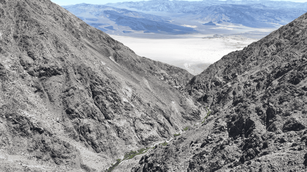
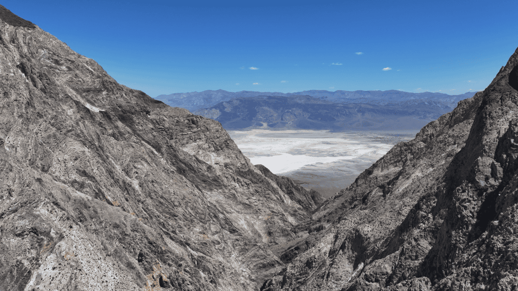
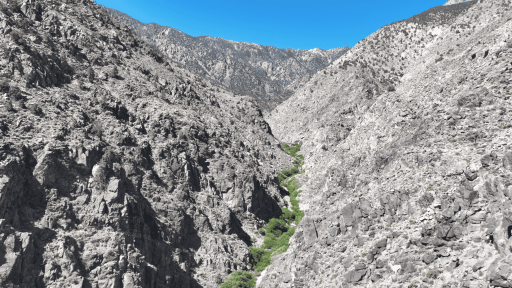
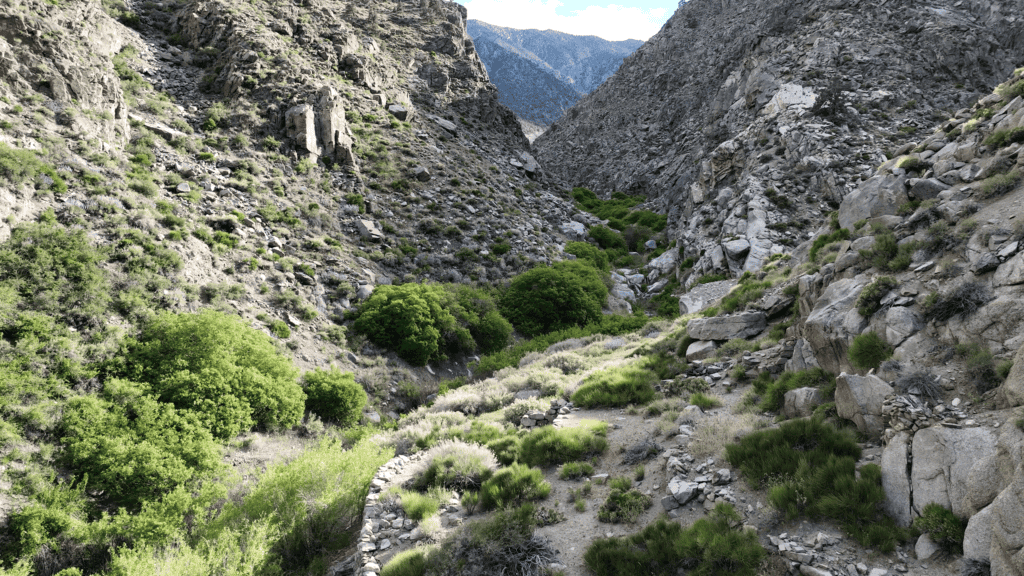
The Eastern Canyons: A World Apart
The eastern side of the Inyos, dropping toward Saline Valley, holds the most dramatic – and least forgiving – terrain in the range.
A series of steep, narrow canyons – Craig, Beveridge, Hunter, McElvoy, Pat Keyes, and others – cut thousands of feet through vertical walls.
Because they’re so deep and narrow, sunlight is a rare commodity.
An 1880 reporter noted that the camp at the McEvoy Mill received just one hour of sunlight per day in winter. 4 At another camp, Juarez City, the sun didn’t shine for four months. 5 In some places, it never reached the canyon floor at all.
These weren’t complaints.
They were just facts of life.
The History of Mining in the Inyo Mountains
The history of the Inyos is the history of people doing impossibly hard things for money.
And it doesn’t begin with the Anglo-American miners of the 1870s, but with Mexican miners working these canyons a decade earlier, in near-total obscurity.
Cerro Gordo: The Mine That Built Los Angeles
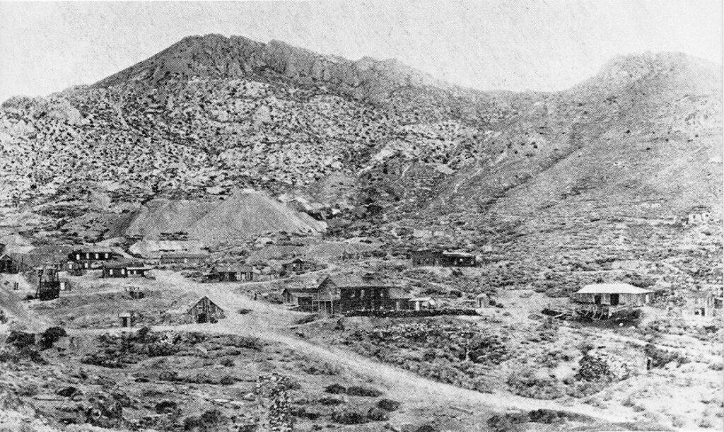
Before we get to the deep canyons of the Inyos and the Beveridge district, we have to start at the southern end of the Inyos, at Cerro Gordo – the mine I now call home.
In 1865, a prospector named Pablo Flores is credited with discovering a rich silver deposit 6 on a “fat hill” – cerro gordo in Spanish – at the southern end of the Inyo Mountains. By 1870, the town was booming, with a population of 500–600 7 and smelters turning out nine tons of silver and lead ingots per day. 8 For a few short years, annual production ran around $1,000,000 in silver and lead. Historian Remi Nadeau, whose great-great-grandfather ran the mule freight teams, wrote that Cerro Gordo was “the Comstock for another California city – Los Angeles.” During 1874, nearly one-third of all tonnage leaving Los Angeles for the Owens Valley was Cerro Gordo bullion. 10
In total, Cerro Gordo produced over 4.4 million ounces of silver, 2,010 ounces of gold, 35,800 tons of lead, 11,900 tons of zinc, and 286 tons of copper. 11 Cumulatively worth more than $500 million in today’s value.
If you’re interested in my efforts to restore Cerro Gordo, check out my YouTube channel GhostTownLiving.
The Mexican Miners and the “Pure Gold Balls”
Long before the large-scale Anglo mining operations moved into the northern Inyos, Mexican miners were working the deep canyons using stone arrastras — primitive grinding wheels powered by mules walking in circles. A report from 1885 dismissed this work, stating the mines “are principally owned by Mexicans and worked only when the necessities of the owners demand.” Local newspapers described the Beveridge district as a “recent discovery” when Anglo miners arrived in 1878 — completely ignoring the decade of Mexican mining that preceded them.
Their stone arrastras — circular grinding tracks worn into the rock — are still visible in several canyon locations today. Here is an example of one seen in Pat Keyes canyon
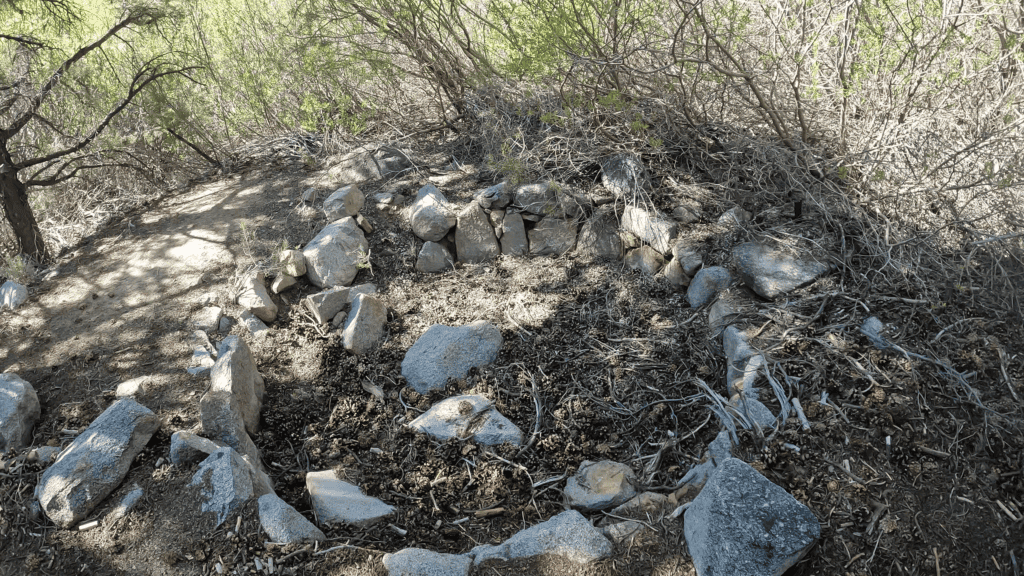
In 1879, a Bodie newspaper reported that these miners were pulling out “pure gold balls varying in size from a bullet to a hen’s egg.” They were not wrong.
The Founding of the Beveridge Mining District
On December 7, 1877, a group of miners gathered at Big Horn Spring 14 in Hunter Canyon to make it official.
William L. Hunter – who had located the first claim in the area – was elected chairman. He proposed naming the new district after his recently deceased friend and mining partner, John Beveridge.
Hunter wasn’t just another prospector passing through. Before coming west in 1868, he’d served in the Confederate Army. In California, he ran a pack train of up to 200 mules and worked the mines at Cerro Gordo. (His cabin in Cerro Gordo still stands today and is being restored into a recording studio.)
When the silver there began to fade, he pushed north into these canyons, chasing the next opportunity.
And when it came time to name the district, he chose Beveridge—the man he’d known during his years at Cerro Gordo.
A way, I think, of tying the two places together. Which adds a personal touch for me when I’m trekking deep into the range.
The Boom Period: 1878–1906
By 1880, the district was fully alive.
Mills were running in multiple canyons. Ore was being crushed day and night. One reporter who made it out that year called it “too grand, gloomy, and gorgeous to be described in words. It must be seen and traveled over to be appreciated.” 15
Getting anything into these canyons was its own kind of accomplishment.
There were no wagon roads into the Beveridge district – not a single one. Everything came by train to Keeler at the base of the mountains, then was packed onto mules, hauled over the 11,000-foot summit of New York Butte, and dragged down canyon walls on wooden skids. Steel, timber, food—everything followed that same path.
The people living out here were cut off for months at a time.
When I first hiked into these canyons and started finding old wooden crates tucked into caves—still stamped with the names of Keeler merchants from the 1880s—that whole supply chain stopped being abstract.
Everything came through Keeler.
That box was the last thing a mule touched before the mountains swallowed it.
At the peak of the boom, there were more than 111 named mines in the district. 16 Total production is estimated at around 38,000 ounces of gold and 39,000 ounces of silver 17—nearly $100 million at today’s prices.
All of it pulled out of the rock by hand.
In a place where, in some of these canyons, the sun didn’t shine for four months of the year.
The Mines, Mills, and Camps: A Canyon-by-Canyon Guide [South to North]
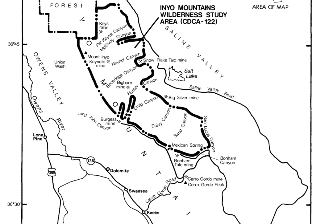
Cerro Gordo
At the southern end of the Inyo Mountains, accessible by a paved road from Keeler, Cerro Gordo is the most accessible and best-documented site in the range. The town sits at 8,200 feet on the western face, overlooking Owens Lake. At its peak it had a population of 500–600 7, with two rival smelters, saloons, a hotel, and a relentless output of silver and lead.
Today I’m working to restore it. I’m rebuilding the American Hotel. The hoist house over the Union Shaft still contains its original equipment. Cerro Gordo is the entry point for understanding the Inyo Mountains — the place where the wealth came from, and the place that set the stage for everything that followed in the canyons to the north.
Daisy Canyon / The Saline Valley Salt Tram
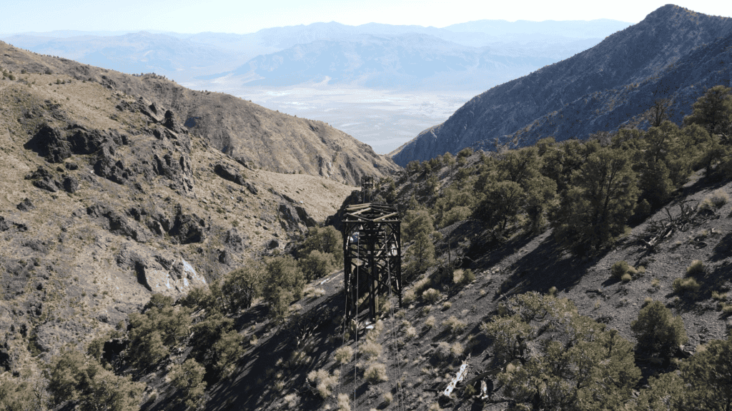
Just north of Cerro Gordo, on the eastern side of the Inyos, is Daisy Canyon. And running straight through it is one of the most ambitious engineering projects ever built in the American West.
The Saline Valley Salt Tram.
Built between 1911 and 1913, it’s a 13-mile electric aerial tramway 18 carried salt—almost perfectly pure—from the floor of Saline Valley (now in Death Valley National Park), up over the crest of the Inyos, and down to the railroad at Keeler in the Owens Valley.
At the time, it was the steepest aerial tramway in the United States. 18 The details almost don’t make sense when you see them laid out.
Buckets moved along the line at 5.5 miles per hour, each carrying up to 700 pounds of salt. 18 The system was powered by five Westinghouse electric motors. 18 From the valley floor to the crest, the line climbed 7,600 feet, then dropped another 5,100 feet 18 into Owens Valley—a vertical change greater than the height of the Grand Canyon.
They thought it would cost $250,000 and be finished by May of 1912.
It ended up costing $750,000 and wasn’t completed until July 1913—more than a year late.
Daisy Canyon was the hardest part of the entire route.
The terrain here is so steep that building a road wasn’t an option. To get materials into place, they had to build temporary tram lines just to construct the real one. Pack mules hauled massive cables through the canyon—sometimes in a single continuous piece.
During construction, workers rode the line itself. As they crossed over Daisy Canyon, they could look straight down and see fallen tram cars scattered across the canyon floor.
Even then, it was dangerous.
At the top of the canyon, the Summit Control Station and Power House still stand, largely untouched—mostly because they’re too difficult to reach for anyone looking to haul them out.
It can be accessed starting in Cerro Gordo and driving along a beautiful ridge road. Here is a video of that drive.
The towers stretch across the mountains in a line that still feels improbable, following terrain that doesn’t look like it should allow anything like this to exist.
The tram operated off and on from 1913 to 1935 18, under a series of different companies, until the Sierra Salt Company finally went bankrupt and shut it down.
Today Daisy Canyon is a difficult canyoneering route, with rappels and dry waterfalls. I took on the hike early in my days living at Cerro Gordo, and it didn’t end well. You can watch that adventure here.
A reminder that the most ambitious project in the Inyos wasn’t a mine.
It was this.
The Burgess Mine and Kate Wells
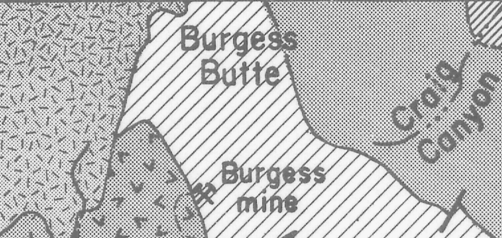
At the southern edge of the Beveridge district, near the crest of the Inyos, sits the Burgess Mine. It’s the only mine in the district you could actually reach by wagon road, and is still accessible further down the road from Cerro Gordo to the Salt Tram.
For much of its history, it was owned by a woman named Kate Wells, out of Big Pine. The mine itself sits at around 9,200 feet. By the time it was fully developed, it had an inclined shaft running 200 feet deep, two vertical shafts, and a crosscut tunnel stretching roughly 700 feet. 19 By 1935, total production was around $30,000. Not one of the big producers in the district. But one of the few you could get to without a mule and these days acts as a jumping off point for many of the adventures into the Inyos.
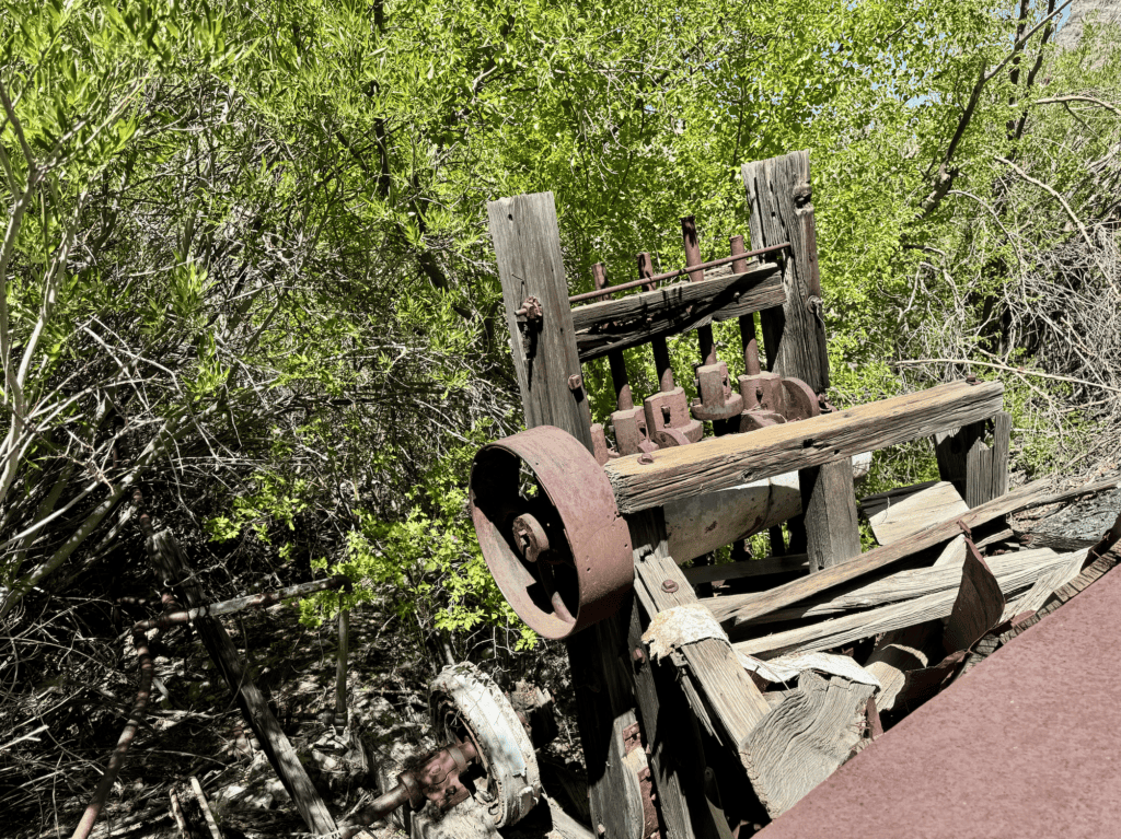
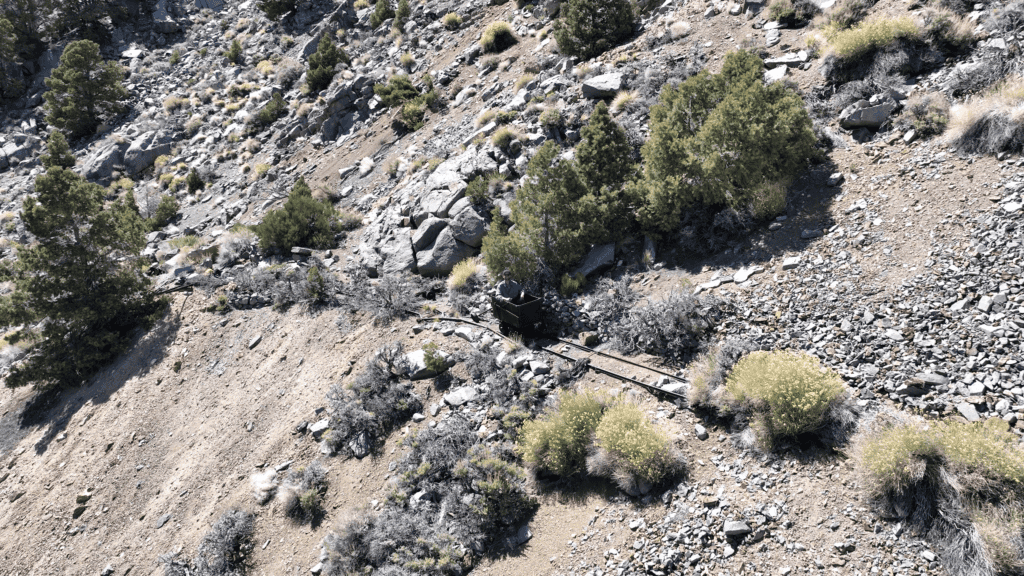
Craig Canyon / Trepier Mine / American Flag Mine
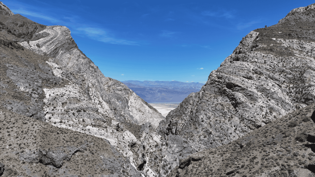
Craig Canyon cuts east off the Inyo crest, dropping hard toward Saline Valley.
It’s one of the least-visited—and least-documented—canyons in the entire range.
The canyon starts relatively wide, then quickly tightens into steep slot sections—at times no more than six feet across, with rock walls rising hundreds of feet on either side.
Near the mouth sits the American Flag Mine.
It wasn’t a major producer by district standards—about 200 ounces of gold and 500 ounces of silver from roughly 400 tons of ore 21—but it was enough to justify building a mill in one of the most difficult places imaginable.
That mill sits three miles away, at the bottom of the canyon.
I first came across it in an obscure 1992 trail report written by Steve Smith. After digging into it—and a couple of failed attempts—I finally made it down to the five-stamp mill.
It’s still standing.
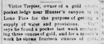
On the way down, I passed the Trepier Mine, worked by Victor Trepier in the 1890s. It’s a classic pocket mine—small, but chasing incredibly rich veins.
In June of 1894, Trepier walked into Lone Pine and told a reporter he’d hit a pocket the week before—about three ounces of gold. By the end of the month, he’d produced fourteen ounces. 22
Further down the canyon, scattered through the scree, are small prospects. Inside one, I found a wooden shipping crate stamped “E.B.H., Keeler, Cal.”
Keeler was the railroad terminus at the base of the mountains—the last stop before everything had to be packed in by mule.
The canyon itself is a serious undertaking. It’s steep, loose, and technical in sections—and there have been reports of mountain lions moving through it.
Hunter Canyon and the Big Horn Mine
Hunter Canyon also drops east off the crest of the Inyos, falling steeply toward Saline Valley.
It’s named after William L. Hunter—the man who made the first gold discoveries here in the late 1870s.
One of the earliest operations in the canyon was the Big Horn Mine, which quickly became one of the six principal mines in the district.
By 1878, Hunter and his partners were already running three steam-powered arrastras in the canyon. 23
A reporter visiting at the time described one of the shafts as 170 feet deep, with a vein two to four feet wide that “crops out for a distance of over two thousand feet in length.” 24
Hunter worked the mine until his death in 1902. After that, it continued on and off into the 1930s.
In total, the operation produced around 1,600 ounces of gold and 9,600 ounces of silver. 25
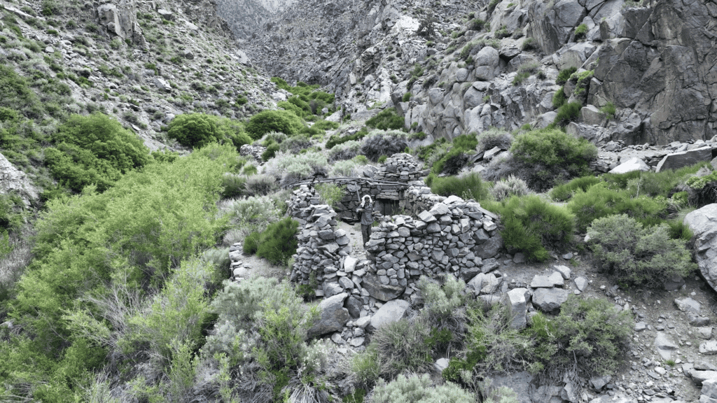
Beveridge Canyon (and Ghost Town)
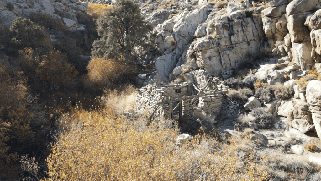
Beveridge Canyon is the center of the district—the canyon that gives the whole area its name. It is also the canyon with the most substantial mining equipment left behind. These days there is still a stamp mill, aerial tramway, steam boilers, and a number of stone cabins. The reason so much remains is that getting there is no small thing. It requires a long hike either down from the Inyo crest, or up from Saline Valley. It is the heart of the Lonesome Miner’s Trail, and has been described as “the most remote ghost town in America.” If you’re interested in a video outlining the hike and what is left of the town, you can watch my trek here.
The Beveridge Mine itself—the one the canyon is named for—wasn’t the largest producer in the district, but it was significant enough: around 300 ounces of gold and 1,000 ounces of silver from roughly 1,000 tons of ore. 26
There were other operations spread through the canyon as well.
The Philadelphia Mine, run by Dominico Calsagia & Co., had a large stone residence at the site—unusual for how remote this place is. In 1886, Calsagia hauled 2,200 pounds of ore out to Keeler that was valued at over $400 per ton.
Another claim, the Borago Broncho Mine—likely named from the Spanish borrego bronco, or “wild sheep”—was considered one of the richer deposits in the canyon, with ore expected to yield over $200 per ton.
And then there were the smaller, less defined workings—what were referred to as the Beveridge Canyon Mines. Roughly a dozen operations, feeding ore into the McEvoy Mill.
By 1935, their total recorded production was about $10,000.
Not a huge number.
But when you’re standing in that canyon—looking at what it took just to build anything there—it feels like a lot more.
The Keynot Mine
The Keynot Mine was the largest and most productive operation in the district — an estimated 29,000 ounces of gold by 1906 30, roughly $420,000 in 19th-century dollars ($130 million today). It’s the reason this entire network of trails exists. Nearly every person living in these canyons was here, directly or indirectly, because of what was coming out of this one mine.
At its peak, around 50 men were working here. Even the lowest-grade Keynot ore yielded around $58 per ton. Much of it yielded over $200. To process it, they hauled everything three miles up and over the canyon walls to the stamp mill in Beveridge Canyon.
A century later, someone decided to try again. In 1983, a company called Far West Exploration helicoptered in 32 a full cyanide recovery operation at 8,000 feet: a bulldozer, a Caterpillar generator, a 250-ton-per-day processing plant. All of it flown in piece by piece over a mountain range with no roads. The entire operation was a mess and they lasted less than a year. The equipment never left. I’ve met people who worked there in the 1980s who still live in Keeler.
When I came across that bulldozer, sitting exactly where someone parked it over 40 years ago, I kept thinking about the day it arrived. The noise of the helicopter, the excitement, the certainty that this time it was going to work. And then the day they realized it wasn’t, and had to leave it all behind in the canyon. The 1880s miners and the 1983 speculators were separated by a century, but they were after the same thing, and the mountain beat them both the same way.
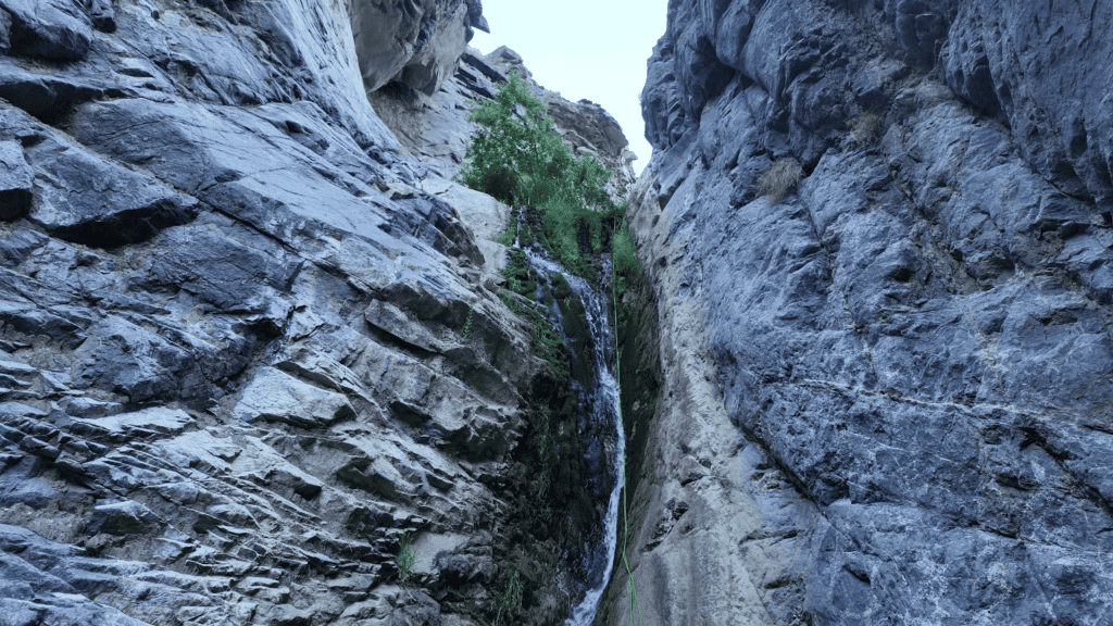
McElvoy Canyon and the Beekeeper
McElvoy Canyon is one of the largest and most dramatic canyons on the eastern flank—defined by a strong perennial stream, year-round waterfalls that are up to 150 feet tall, and pockets of lush vegetation that feel out of place in the surrounding desert. It’s my favorite of all the Inyo canyons because of its vegetation, waterfalls, and lore.
The McEvoy Mill was the first significant ore-processing facility in the Beveridge district, crushing ore from multiple mines through the early 1880s. A report from 1882 noted that seven tons of ore from one mine alone yielded 30 ounces of gold. 33 The foundation of this mill still exists today, as well as a large stone cabin in the canyon floor.
But the most remarkable chapter of this canyon’s history doesn’t come from the 19th century.
In the 1960s, a man named Marion Howard left behind his normal life and moved into the canyon.
His route was the same one I took: from Lone Pine at 3,500 feet, up and over 11,000-foot Keynot Pass, then back down to roughly 3,500 feet on the Saline Valley side. He made that crossing about once a week.
He didn’t use a pack frame – just a canvas duffel thrown over one shoulder.
Over the course of 20+ years he built numerous stone huts in the canyon, and reworked some of the old mineshafts into living quarters. To get down the series of waterfalls, he handbuilt wire ladders, which were up to 150 feet long.
During all that, he quietly kept bees, dozens of miles from the closest paved road. He carved out a life in one of the most inaccessible canyons in the United States.
When I made it into McElvoy Canyon and found his smoker, his beekeeper’s net, his canvas duffel sack still sitting in the ruined hut, it was one of the more memorable moments I’ve had out here.
I’d read about him for years. Being there—holding the tools of someone who chose this canyon and made a life in it—felt different. That’s the thing about these places.
You think you’re going to another old mining site, and then you come around a corner and find a waterfall, a patch of green, and the remains of someone’s entire life sitting quietly in the rocks.
I’m currently working on a full-length book about Marion Howard, but you can read a longer blog post about him and the canyon here.
Pat Keyes Canyon
The most northern officially named canyon in the Inyo range is Pay Keyes Canyon.
Pat Keyes Canyon is named after the Irish miner Patrick Keyes, who established a productive gold operation here in 1887.
In December 1895, Keyes brought 13 ounces of bullion into Independence—the result of working just 10 tons of ore. 34 By July of the following year, a single clean-up yielded around $3,000 worth of gold.
His setup was about as simple as it gets: a pickaxe, a mule, an arrastra, and the idea that you could come out here and make something happen.
From what I can tell, he did.
The circular grinding tracks from his arrastras are still visible near the canyon’s spring, along with stone cabins, scattered blasting cap tins, and the remains of the milling equipment.
When I was there, I found his canteen and old tin cans still sitting in the dirt. Standing there, it’s hard not to think about what his days looked like—what he was working toward, and whether he had any sense that someone might come through a century later trying to piece it all back together.
Hiking the Inyo Mountains: What You Need to Know
If you decide to hike the Inyos, you need to be prepared.
There are no maintained trails. You’ll be following old prospector routes, game trails, or navigating cross-country by topography. The most famous route — the Lonesome Miners Trail — is roughly 50 miles, dropping in and out of five canyons with nearly 25,000 feet of elevation gain and loss. It is not a trail in any modern sense. It is a route that requires constant navigation and a willingness to accept that you might not make it.
The footing is consistently terrible. The rock is fractured and loose — hiking here often feels like walking on sliding shale on a 45-degree incline. Brush in the canyon bottoms is thick and thorny. There are rattlesnakes, ticks, and mountain lions.
A typical day might involve dropping 3,000 feet into a canyon, exploring what’s at the bottom, and then climbing that same 3,000 feet back out on loose scree. There is no alternate route, no easy way out. No way to bail.
Water is the most critical limiting factor and the thing I think about most on every one of these hikes. The springs are real, but they are not guaranteed. A spring that ran in April may be dry in June. You must carry enough water to survive if the source you’re counting on isn’t there. I’ve done this hike worrying about water every single day, and even with good information the uncertainty doesn’t go away.
If you haven’t done significant off-trail hiking in desert terrain, the Inyos are not a great place to start. When something goes wrong in one of these canyons — and things do go wrong — there is no rescue coming quickly. You have to be entirely self-sufficient.
All that said, that is why the Inyos are so special. They still feel wild. In a way that is very hard to find in the United States. And why they are my favorite mountain range.
Why the Inyo Mountains Remain Largely Forgotten
The Inyos suffer from a kind of middle-child syndrome. To the west, the Sierra Nevada gets the attention—the national parks, the infrastructure, the crowds. To the east, Death Valley has the extremes and the novelty. The Inyos get ignored. They’re managed mostly by the BLM and the Forest Service, with very little emphasis on expanding the recreation.
There’s also the simple fact that the Inyos are hard. Not in the way a long Sierra hike is hard—but in a way that forces you to accept that the terrain might beat you, that there isn’t an easy way out, and that you could be out there for days without seeing another person. That kind of difficulty keeps most people away.
But the history here hasn’t been cleaned up or put behind velvet ropes. It’s still out there, sitting in the canyons, waiting for anyone willing to go find it. A rusted piece of machinery. A faded name in a logbook. A business card in a glass bottle. A beekeeper’s net still hanging in a ruined hut.
Each of those things says something about the people who came out here. Their ambition. Their stubbornness. Most of them are forgotten.
Exploring these places is one way of remembering them—and I think that matters more than most people realize.
So go. Understand the history around you. Bring it back to life.
Just bring enough water, and tell someone where you’re going.
And if you’re looking for more information on any of the individual hikes, check out my posts below, or feel free to shoot me a note on Instagram. I am happy to help out however I can.
Sources and References
1. Inyo Independent, November 27, 1880. Cited in: Swope, K.K. (1993). With Infinite Toil: Historical Archaeology in the Beveridge Mining District, Inyo County, California. Ph.D. Dissertation, University of California, Riverside, p. 110.
2. U.S. Geological Survey. Waucoba Mountain Quadrangle, California.
3. Nelson, C.A., Hall, C.A. Jr., & Ernst, W.G. “Geologic History of the White-Inyo Range.” Natural History of the White-Inyo Range. University of California Press.
4. Inyo Independent, December 11, 1880. Cited in Swope (1993), p. 111.
5. Inyo Independent, December 25, 1880. Cited in Swope (1993), p. 111.
6. Likes, R.C. & Day, G.A. (1975). From This Mountain: Cerro Gordo. Chalfant Press.
7. Ibid.
8. Ibid.
10. Ibid.
11. Merriam, C.W. (1963). Geology of the Cerro Gordo Mining District, Inyo County, California. USGS Professional Paper 408.
14. Inyo Independent, December 22, 1877. Cited in Swope (1993), p. 260.
15. Inyo Independent, October 23, 1880. Cited in Swope (1993), p. 211.
16. Swope, K.K. (1993). With Infinite Toil: Historical Archaeology in the Beveridge Mining District, Inyo County, California. Ph.D. Dissertation, University of California, Riverside.
17. Close, T.J. (1985). Mineral Resources of the Inyo Mountains Wilderness Study Area, Inyo County, California. U.S. Bureau of Mines / U.S. Geological Survey Bulletin 1708-A.
18. National Park Service. Saline Valley Salt Tramway Historic Structure Report. Death Valley National Park, 2021. See also: “Saline Valley salt tram.” Wikipedia.
19. Swope (1993), p. 367.
21. Close (1985). USGS Bulletin 1708-A.
22. Inyo Independent, June 29, 1894. Cited in Swope (1993), p. 520.
23. Swope (1993), p. 348.
24. Inyo Independent, September 28, 1878. Cited in Swope (1993), p. 349.
25. Close (1985). USGS Bulletin 1708-A.
26. Ibid.
30. Close (1985). USGS Bulletin 1708-A.
32. Swope (1993), p. 455.
33. Report of the Director of the Mint (1883). Cited in Swope (1993), p. 415.
34. Inyo Independent, December 20, 1895. Cited in Swope (1993), p. 493.